Current cyclones and Watching


Tropical Storm Laura # 8 - August 21, 2020 - 14:00 AM UTC

Le 21 août 2020 à 10:00

By Olivier Tisserant
4.93/5 (45)

Reminder: the information and illustrations on this site are NOT INTENDED to protect property and people from cyclonic risks. For this, you must follow the information and recommendations of your prefecture for France and the competent authorities for other territories.

This article is not up to date. A more recent is here

 
I tirelessly draw attention to the fact that cyclone weather forecasts, whatever their origin (models, forecasters, etc.) must be taken with extreme caution. We have proof of this once again today with, fortunately, few consequences.
 
Depression 13 has just been classified as Tropical Storm “Laura” this morning, following the investigation of a Hurricane Hunter (I take this opportunity to thank the nhc and NOAA who help our islands extraordinarily well with their air means). It was long overdue so it does not fundamentally change the established risk. On the other hand, what was not is that it is centered on 17N (the Hunter's reading is even on 16.7) or more than 150 km further south than what the forecasts announced!
Tropical Storm Laura
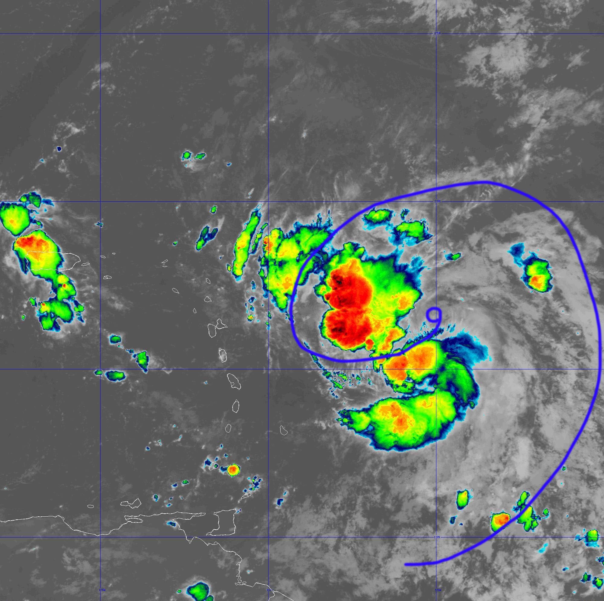
From this morning, on the infra red satellite loops, a doubt began to take shape about its position. A winding seemed to establish itself to the SE of the most active convection zone. It was only a visual impression, so rarely relevant, but looking at the image now makes a lot of sense.
 
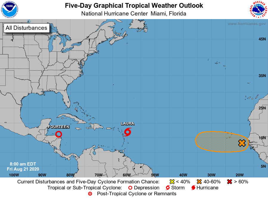
Relocating further south does not have enormous effects compared to what was envisaged and especially none compared to satellite imagery which of course does not change with wind and strong convection always in the same areas. , or north of this new center. On the other hand, it could have a lot of consequences for the following days: its trajectory could be largely revised by the models and this center further south seems in an area more conducive to a little faster reinforcement and the area of ​​the Virgin Islands and from Puerto Rico would be well advised to be very careful.
 
Regarding the West Indies and given the proximity, we can already say that it will start very quickly (Guadeloupe is already affected by a very active convection zone) for rain and thunderstorms and that the center of the arc could be more affected by these stormy conditions. For the Northern Islands, conditions should be close to what Météo France announced, but everything depends on the current trajectory which is not very clear. A full westerly course could bring stronger winds than expected later in the day and evening with gusts that can exceed 40 kts.

Either way, a tropical storm is hitting the northern half of the arc and it's not trivial. We must be very careful because significant accumulations of water are expected locally and quite violent gusts of wind could be observed over the Northern Islands. At least.


I would do something again in the afternoon when we will see a little more clearly. But the 12 hour runs of the models should not take into account these changes, which arrived too late to be initialized on time, so we will probably be a bit blind for the next few hours. Be careful.


To follow the live figures of storm Laura, it is HERE.

To follow the evolution in your territory if it is concerned, the dashboard is LA.

Please rate this item

Comments

Subscribe
Notification for
guest
0 Comments
Online comments
Show all comments

Translations are automated.

Current cyclones and Watching


Latest videos

ATTE

Disclaimer

TION

This site has been developed for entertainment and understanding the weather in the tropics.

It should only be used NEVER for the safety of people or property.

Only information from your national meteorological service and your civil security should be used in case of proven risk!

Account

Login

[user_registration_my_account]