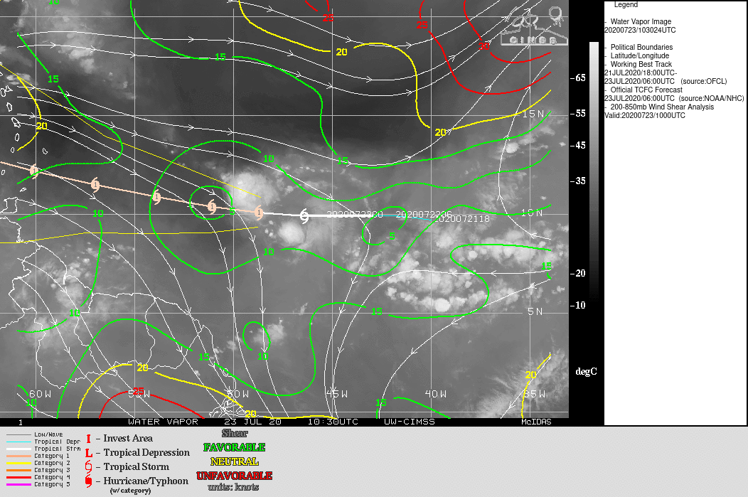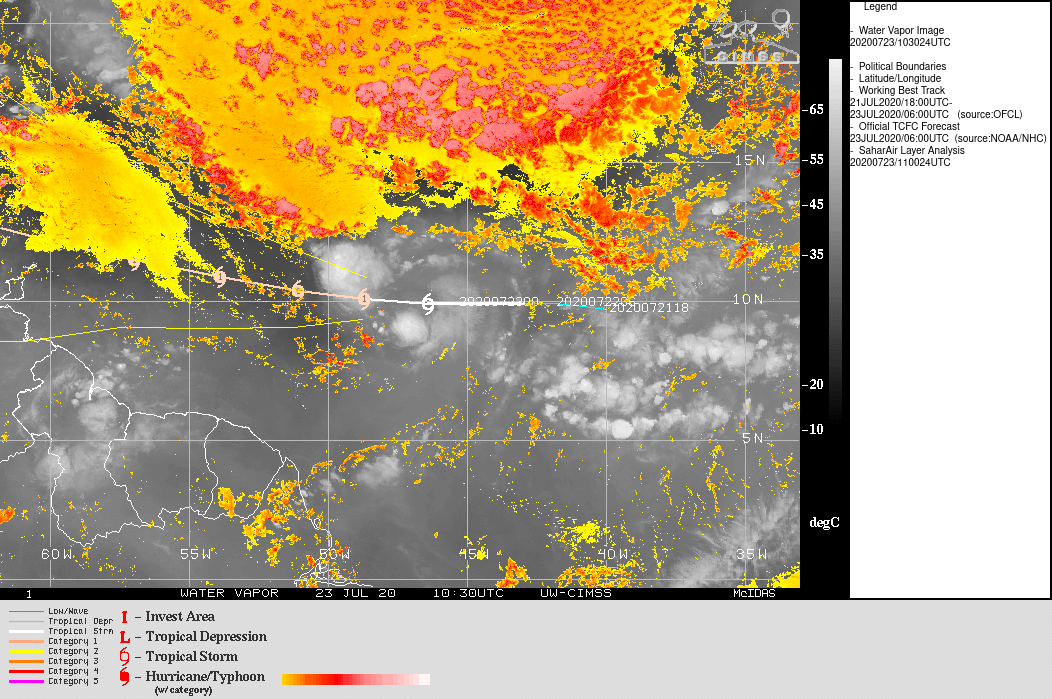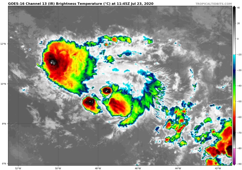
Gonzalo is currently in a delicate phase. Its deep convection has spread a little as it comes in closer and closer contact with the dry air and the internal circulation is more and more difficult to see on satellite imagery. Already last night he had experienced a period of disorganization but he had recovered well that night and continued to strengthen.
This day will be crucial for its development. If it manages to reorganize itself to refocus its convection, it will be necessary to expect that the south of the arc will be impacted by a compact but tough system. If he doesn't manage to reorganize quickly, his debuff could be very fast and marked.
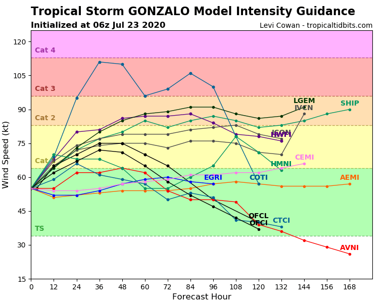 Forecasting models are still so divided and circumspect in forecasting its intensity. It goes from small storm to hurricane Cat. 2, or even 3… in short, it's an incredible mess. It is extremely rare to find in this uncertainty 48 hours after the classification in cyclone. The nhc meanwhile, he tries to position himself on a sort of average between all these forecasts. In any case, the level of confidence in these forecasts (including that of the nhc) remains extremely weak and if you are on the south of the arc you have to take this into account.
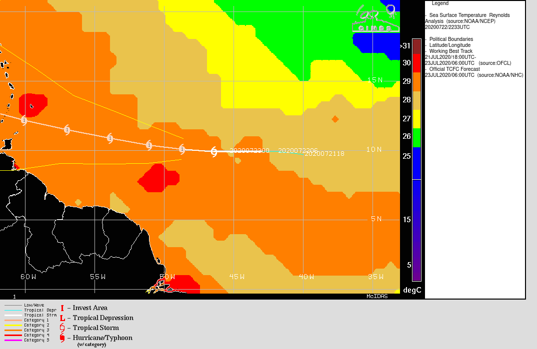
Regarding the trajectory forecast, things are much simpler. A high pressure ridge to its north is driving it westward, slowly for now and little faster from tomorrow.
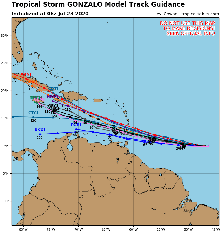 The deviations that can be seen in the forecast at the arc level (and even more afterwards) are mainly related to the uncertainty of intensity. A slightly more intense cyclone may move up a little further north against the high pressures. In this area also the nhc is in a middle position compared to the consensus of the models.
I remind once again that these forecasts have a significant margin of error at 72 hours (over 100km) and that we must therefore remain cautious in the areas bordering the planned passage. And a Cat1 hurricane on Saint Lucia can have consequences on the south of Martinique!