Current cyclones and Watching


Storm Gonzalo - # 3 - July 22 20:30 UTC

Le 22 juillet 2020 à 17:45

By Olivier Tisserant
4.91/5 (46)

Reminder: the information and illustrations on this site are NOT INTENDED to protect property and people from cyclonic risks. For this, you must follow the information and recommendations of your prefecture for France and the competent authorities for other territories.

An update for this article is available HERE.


Clearly, the Gonzalo are quite difficult cyclones to predict and anticipate. Even if this one should not create as many problems as that of 2014 on the Northern Islands, it nevertheless gives a cold sweat to all forecasters, including the most seasoned.

While he was still in Invest with a 20% risk of strengthening 48 hours ago, it is now classified as a tropical storm with some signs of organization quite close to the structure of a hurricane. All while skirting a pocket of dry air to its immediate north and ingesting a lot of dust in its circulation. It is surprising to say the least, and no one or model had anticipated such a scenario.

And by the time everyone has started to get used to the idea that a hurricane is coming soon, he has started to show signs of weakness in his organization for the past few hours.

 
Tempete Gonzalo - satellite visible on July 22, 2020 - 20:30 UTC

Situation

Storm Gonzalo remains very compact with deep convection very much clustered around its center. Its position at 20h UTC was 9.9N by 45W with a displacement of 22 km / h to the west (270 °). Pressure estimated at 1000 hPa and intensity at 45 kts. Satellite wind estimates (Ascat) were close to 50 kts with of course much stronger gusts.

Intensity

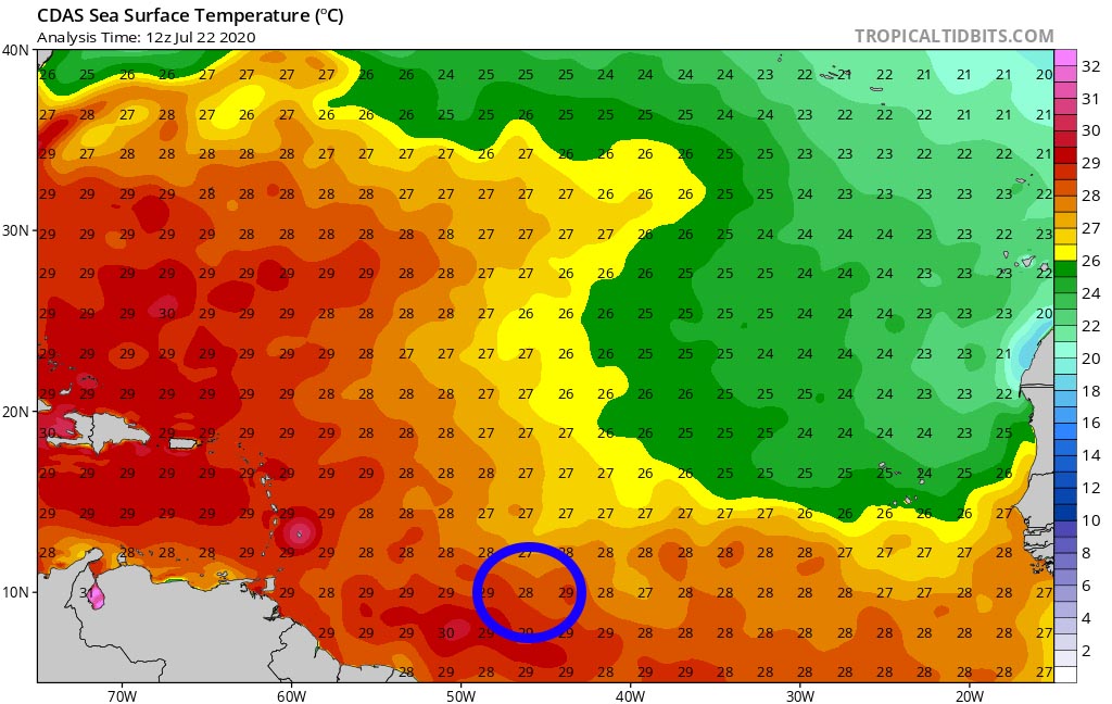
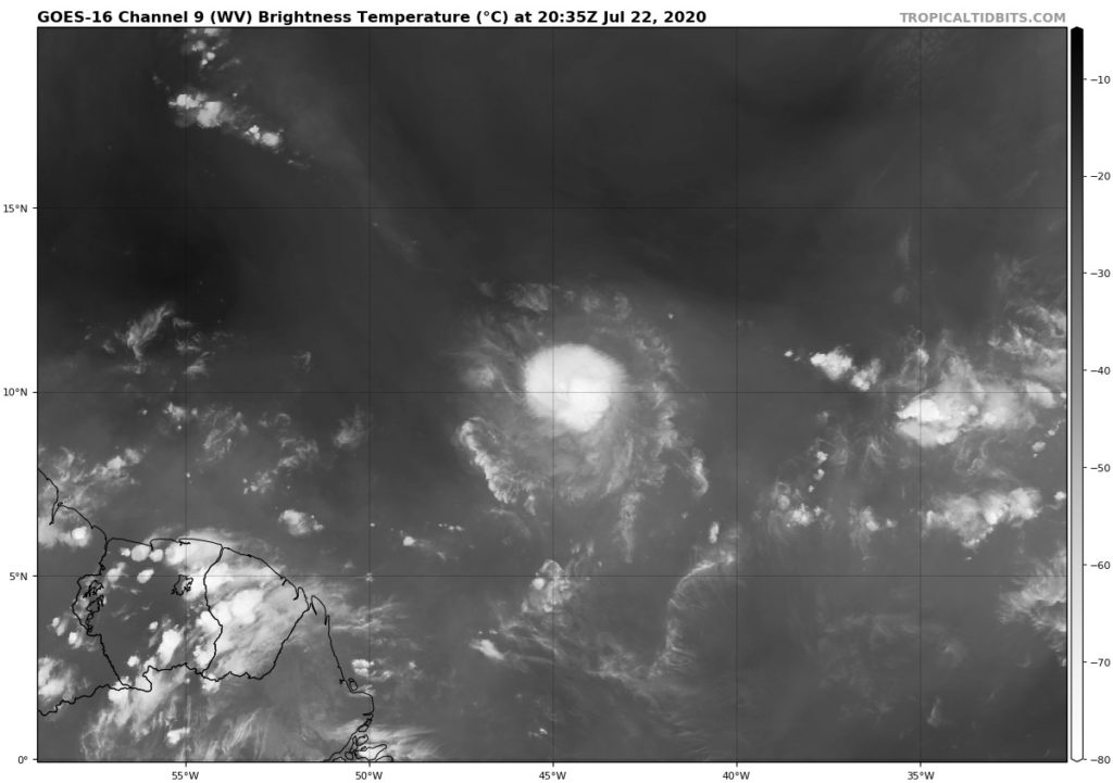
Gonzalo has had a fairly regular reinforcement for 48 hours with an organization still improving, and this despite the dry air and sand to his north which manage to infiltrate his circulation. Until a few hours ago, satellite images showed a fairly robust core with sometimes a central ring forming on microwave imagery. Everything suggested that a rapid intensification into a hurricane was to be expected.

Tempete Gonzalo - Sable - July 22, 2020
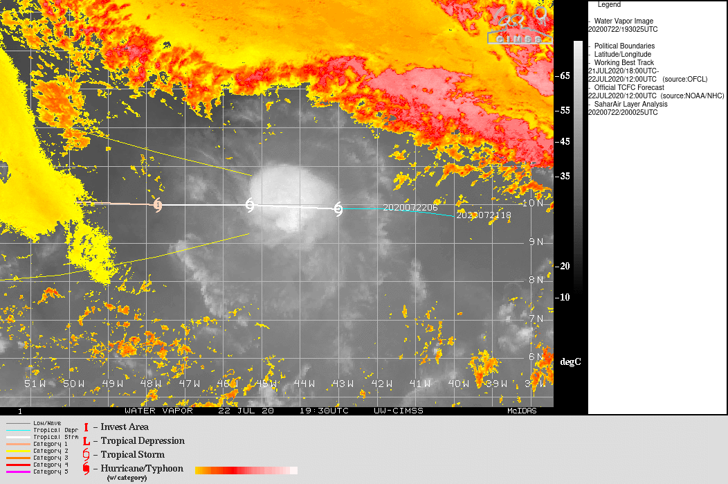
The last images this time show a slightly more erratic circulation and a slightly more diffuse deep convection. Some images perfectly show an entry of dust and dry air from the west into its deep circulation, which probably explains its current difficulties. The question now is to what extent the storm can resist this breach and continue to intensify.

There are now 2 conflicting hypotheses in forecasting models. The first one that includes the model SHIPS which is most used for intensity prediction and model HWRF (model dedicated to the tracking of cyclones) envisages a continuous reinforcement up to the West Indies and a rapid passage to the hurricane stage with a maintenance of 3 days. The HWRF is particularly aggressive on its prediction of intensity with a pressure at 970 hPa and more than 80 kts windy near Barbados.

The second hypothesis is that of global models such as GFS,ECMWF extension and NAVGEM who rather see a short-term strengthening and a very marked weakening at 36 / 48h with a return to the tropical wave stage. The nhc has chosen to place itself halfway with a brief passage at the stage of hurricane and a return in storm for the crossing of the West Indies. It is therefore anything but clear or consensual!

Path

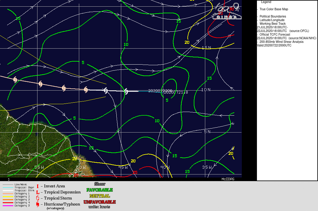
The current track is due west and should be maintained until Thursday / Friday. A fairly strict consensus of the models on the subject indicates a passage on the southern half of the arc for this WE.

Storm Gonzalo trajectory forecast July 22, 18 p.m.

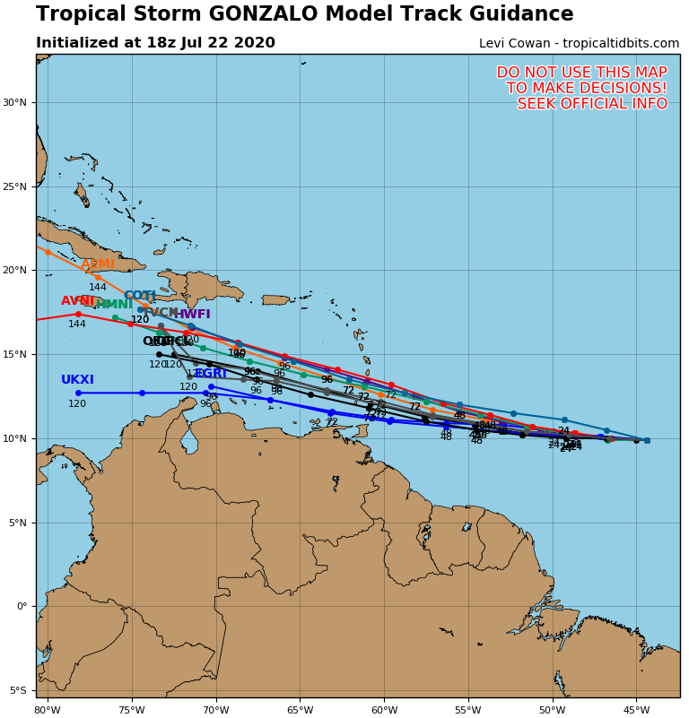
It is quite astonishing and unusual to see that this consensus brings together models that are nevertheless strongly opposed in terms of trajectory. This indicates a real difficulty for forecasting models to correctly read this system.

Its movement speed remains quite slow around 22 km / h but should accelerate in the coming days.

It is essential to take into account the large margin of uncertainty regarding the trajectory of this system. On this map Martinique seems totally out of danger, but at 72 hours this margin of uncertainty remains significant, well beyond 100 km. It is therefore necessary to remain cautious.

Environmental

The environment presents 2 totally opposite faces. On one side hot water (28 ° and more) and a shear very low which are very conducive to the strengthening of cyclones and on the other hand dry air and sand which are on the contrary not at all conducive to strengthening. All the difficulty of forecasting and the indecision of models are due to this opposition of conditions. It is currently absolutely impossible to properly assess the risk of intensity posed by these environmental conditions.

Conclusion

As is often the case with the first cyclones of the season, Gonzalo is very difficult to read and predict. It is located in an area where the environmental conditions are very contrasted and it is impossible to determine what will be its evolution under these conditions. Whether they are the best performing models or the most renowned forecasters, everyone is quite skeptical about this system and no one agrees on its future.

In such a case there is only one solution for the territories on its trajectory or nearby: be vigilant and start to prepare in case the worst scenario becomes reality.

To follow the evolution in real time of this weather system, it's here: Tropical Storm Gonzalo

Please rate this item

Comments

Subscribe
Notification for
guest
0 Comments
Online comments
Show all comments

Translations are automated.

Current cyclones and Watching


Latest videos

ATTE

Disclaimer

TION

This site has been developed for entertainment and understanding the weather in the tropics.

It should only be used NEVER for the safety of people or property.

Only information from your national meteorological service and your civil security should be used in case of proven risk!

Account

Login

[user_registration_my_account]