
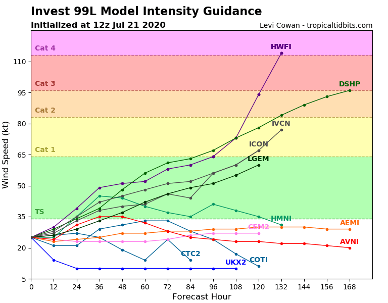
Despite an increasingly marked organization, the intensity remains reasonable at around 20 kts. There is currently no consensus on the forecast models for the next few days. 2 hypotheses clash with, on the one hand, those who envisage a weak evolution at 96H around 35 kts of intensity, that is to say between the depression and the tropical storm and on the other hand those which envisage a rather linear increase in power for the next 4 days, reaching the intensity of a big storm or even a Category 1 hurricane.
 Given the slightly favorable environment for its strengthening, one must consider the possibility that the strengthening may be quite rapid over the next 24 hours and that a good storm will emerge fairly quickly.
Then by approaching the arc, the system should move closer to the drier air and interact more strongly with it, which should limit its possibilities of reinforcement. But with its fairly slow movement speed (around 15 km / h) time will pass before its arrival on the West Indies and there may be changes in the environment by then (between 5 and 7 days) .
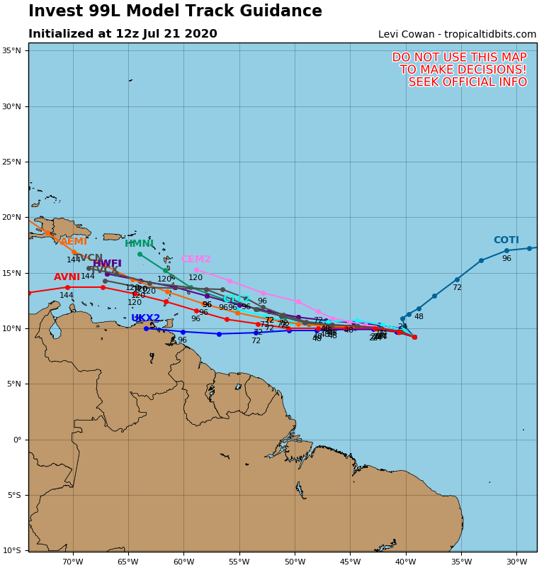
The trajectory forecast is a little less clear than this morning when a fairly strong consensus showed a trajectory over the south of the arc. The rapid organization and the risk of marked reinforcement somewhat divided the beautiful unity of the models on the subject.
 Its slow movement speed also makes this prediction quite tricky.
It must be assumed that in the event of a rapid classification in depression and reinforcement in a storm, a good part of the West Indies could be affected by the risk of passage. In any case, this is what must be done before seeing a little more clearly, even if the risk seems more marked on the south and the center of the arc at the present time.
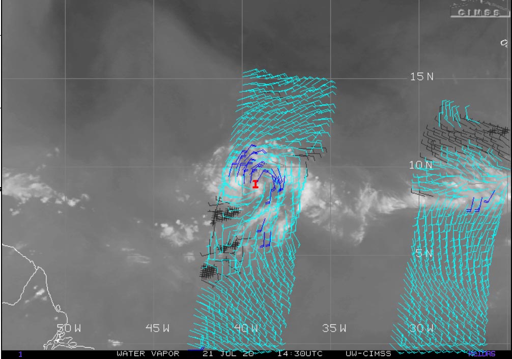
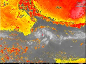
As indicated above, the environment is for the moment slightly favorable to reinforcement, which explains this rapid evolution in its organization. The water is hot, the shear is weak as shown in the left image below and although a pocket of dust and dry air appears to the immediate NE of the system, its current westward trajectory allows it to keep moist air to the south ( image below left).
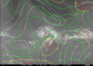
Le nhc seems to be leaning so that this pocket of sand limits the reinforcement in the coming days. It is reasonable to think that if the trajectory were to turn northwards, it would indeed be.

