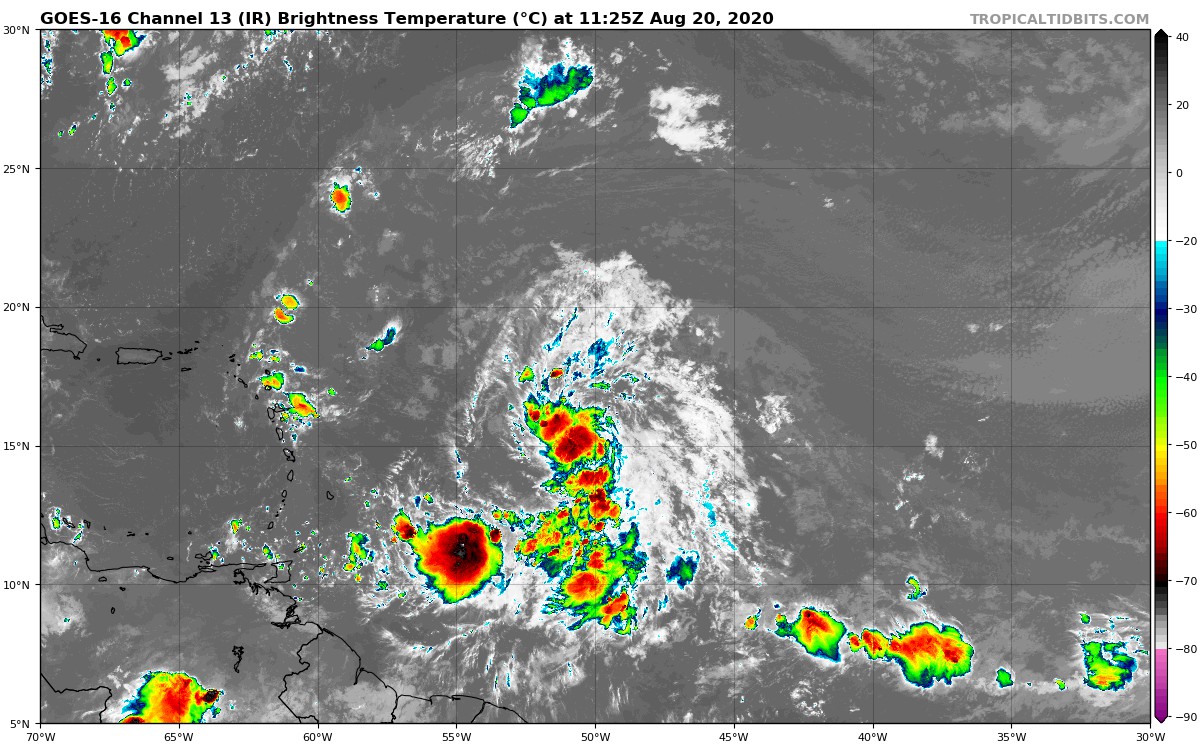
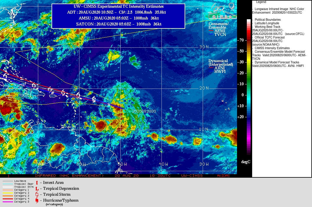
I told you last night, the organization of theInvest 98L had greatly improved in the afternoon and it was logical that she was classified as a depression last night. Its center is estimated at 15.2N by 49.8W, its pressure at 1008 hPa and its intensity at 30Kt. This triggered other automated monitoring tools including Dvorak satellite analysis, which allows us to study the organization and estimate reinforcement risks. This system estimates the intensity at 35 kts in reinforcement which indicates a possible rapid classification in storm and a naming, which would be the birth of Laura.
Nevertheless, visually it does not seem that it is still a storm but we are close to dawn and the rapid change in temperature and therefore modification of the convection. It makes the visual estimation rather difficult. The more so as deep convection centers are also developing much more in the southwest.
Its reinforcement in depression occurred around the convection zone which had been created north of its estimated center. This caused a repositioning of its center almost 3 ° further north than last night. It is a cyclical effect due to the organization and it is not representative of its overall trajectory which remains WNW. We can also thank this jump which still allows us to hope for a passage a little north of the West Indies.

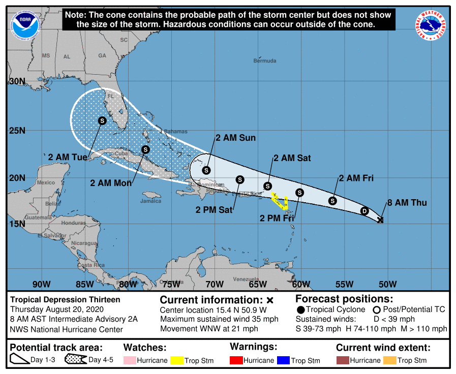
 48 hours from a passage at the longitude of the arc, the consensus of the models both in trajectory and intensity becomes clearer. 2 trends remain for the trajectory, with one right on the northern islands and another a little to the north (privileged for the moment not the nhc). For the intensity, the consensus is for a storm at 48 hours with some discrepancies in some models.
