Current cyclones and Watching


a new Invest 95L threatens the West Indies

Le 12 août 2021 à 18:26

By Olivier Tisserant
4.91/5 (116)

Statistically, the peak of intensity of the hurricane season begins in mid-August and this season does not seem to want to deviate from this rule. In recent days, agitation has become marked on the Atlantic due in particular to the increase in the temperature of the water. The Invest threatening the West Indies follow one another at breakneck speed without creating a very problematic situation. Let's try to see what it is for this Invest 95L.

Invest 95L

Like last week, The nhc has increased its risk almost continuously for 48 hours and it now stands at 60% at 48 hours and 70% at 5 days. This time the disturbance is further from the arc but it advances faster which in the end is the same.

The NHC forecast

Once again the nhc chosen to really increase the risk of reinforcement when no consensus exists on the models in terms of intensity. But forecasters are used to relying quite a bit on the SHIP model which is one of those today who foresee a strengthening for the next few days.

Météo France forecast

Météo France AG does not forecast strong enough winds on the French-speaking islands but forecasts rainy and stormy weather for this weekend. For the moment the French models do not develop this system and this is what explains this forecast of  Météo France.

Forecast models

Concerning the trajectory, a strong consensus is developing for a passage on the northern half of the arc this weekend. It concerns both models specialized in tracking and global models in both their statistical and deterministic versions.

As for the intensity it is about the same thing as for 94L with a very wide range which goes from a maintained in tropical wave to a hurricane of category 1. This important disparity is explained by conditions. rather favorable to reinforcement but with always a lot of dry air (especially at low altitude) likely to thwart the development in a rather unpredictable way.

Conclusion

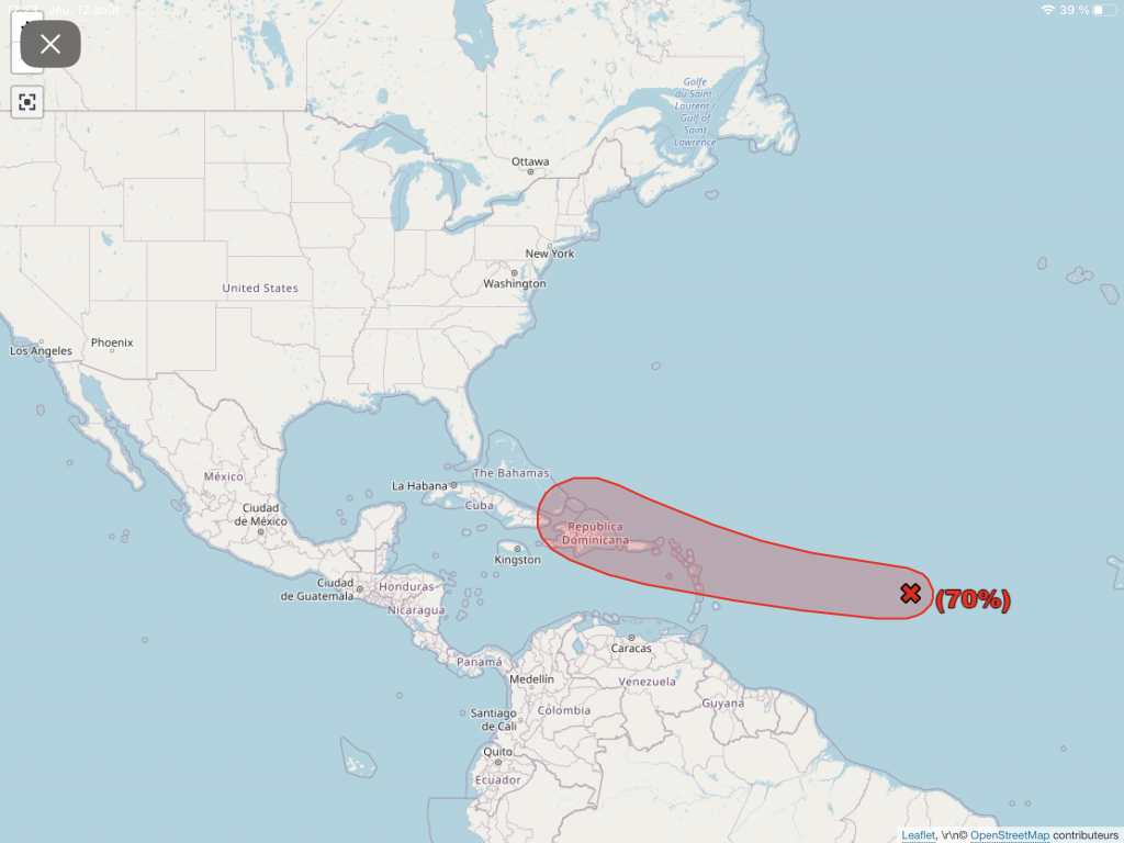
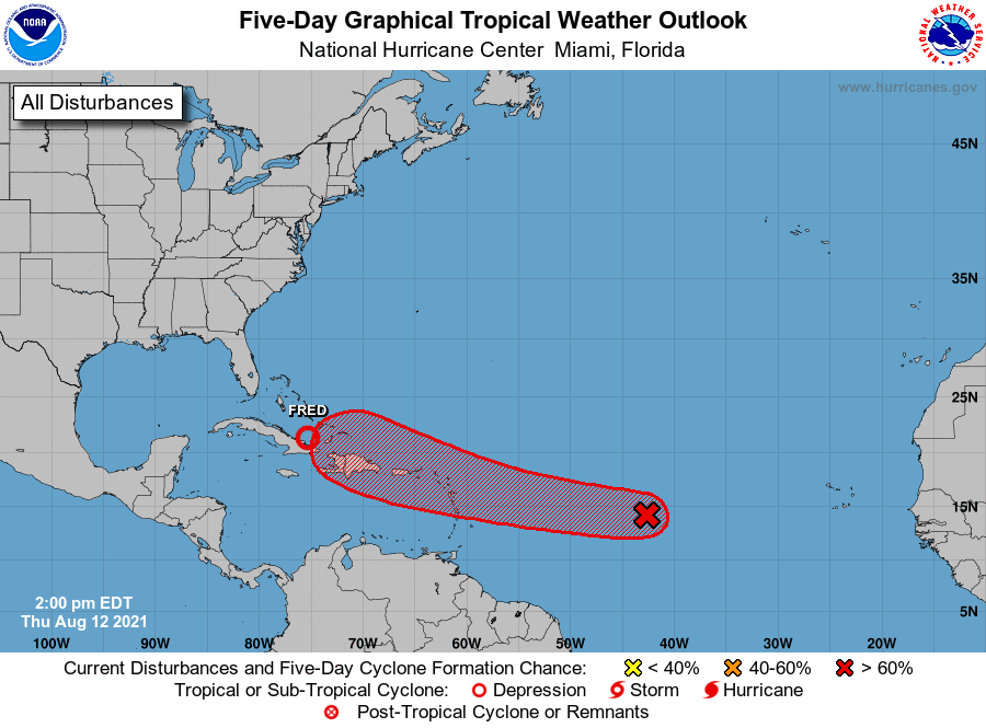
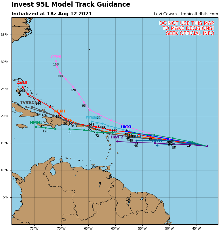
THEinvest 95L is about 48 hours from the West Indies. Its displacement is quite fast WNW and its risk of reinforcement quite high. However, as for the previous one, the conditions are moderately favorable for a reinforcement, which leaves a lot of uncertainties on the intensity at the longitude of the arc.

I am well aware that many of you are waiting for more precise answers, but we are on a subject which does not mix well with certainties. And in this case, this time, it is even more true as it is so difficult to read this system. We can still anticipate that a risk of significant strengthening by the West Indies is very unlikely. But between a wave and a big storm it is not yet very clear. And as always in a case like this we prepare a minimum in case.

I'm on SXM until tomorrow and it's a bit difficult to do a live one tonight at the hotel. So for now you can follow me on  my twitter account. in the event of a big change, I will do a follow-up while waiting for the live tomorrow evening (Friday the 13th) at 18pm.

Image credit: Tropical tidbits nhc et UW-CIMSS

Please rate this item

Comments

Subscribe
Notification for
guest
1 Comments
The oldest
Most recent The most popular
Online comments
Show all comments
Nathalie SUTERA
Nathalie SUTERA
2 years ago

THANK YOU VERY MUCH 👍

Translations are automated.

Current cyclones and Watching


Latest videos

ATTE

Disclaimer

TION

This site has been developed for entertainment and understanding the weather in the tropics.

It should only be used NEVER for the safety of people or property.

Only information from your national meteorological service and your civil security should be used in case of proven risk!

Account

Login

[user_registration_my_account]