
Reminder: the information and illustrations on this site are NOT INTENDED to protect property and people from cyclonic risks. For this, you must follow the information and recommendations of your prefecture for France and the competent authorities for other territories.
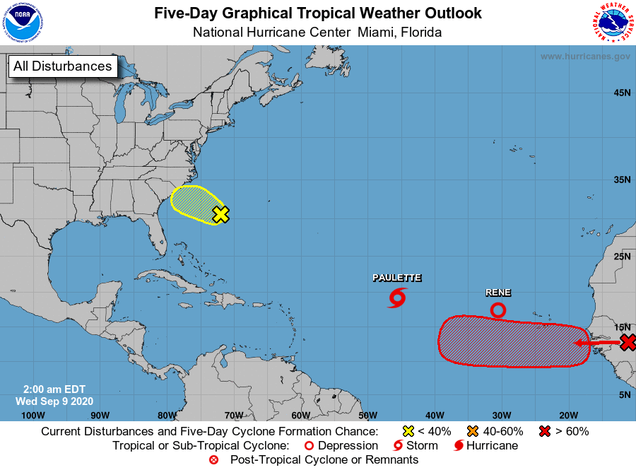
Many of you have asked me my opinion on the disturbance which should emerge from Africa tomorrow and which could threaten the West Indies. Those who know me know that, normally, I do not express myself on a risk with too long a maturity simply because the models are not able to assess a risk with precision beyond 5 days (this is also why the nhc limits its forecasts to 120h). There, we will exceptionally speak of a system which COULD concern the West Indies at 8 or 9 days because the buzz concerning it is taking on significant proportions and you have to put things in their context and understand what we are talking about.
Watch out for fake-news
Demonstration of uncertainty
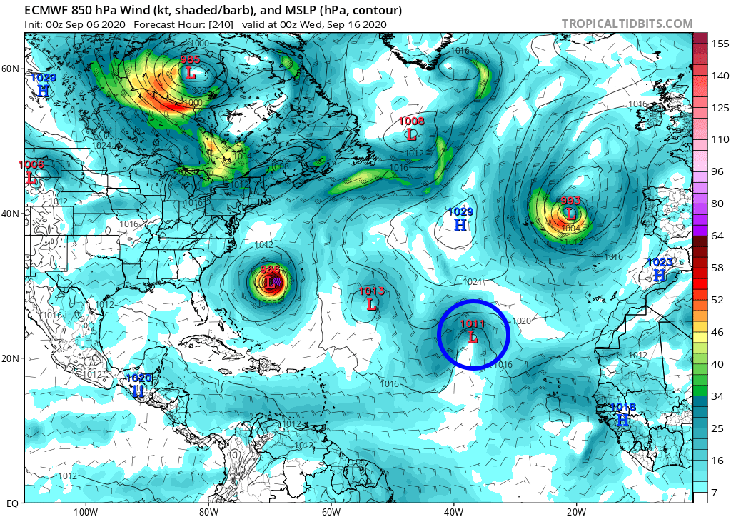
Forecast from 6/9 at 00h
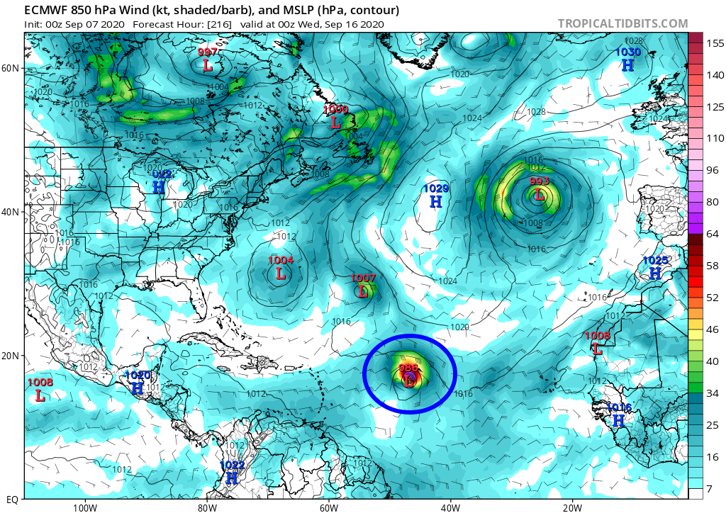
Forecast from 7/9 at 00h
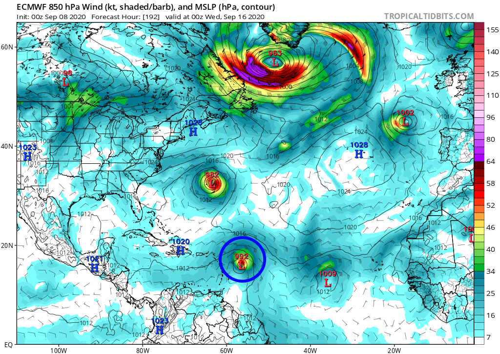
Forecast from 8/9 at 00h
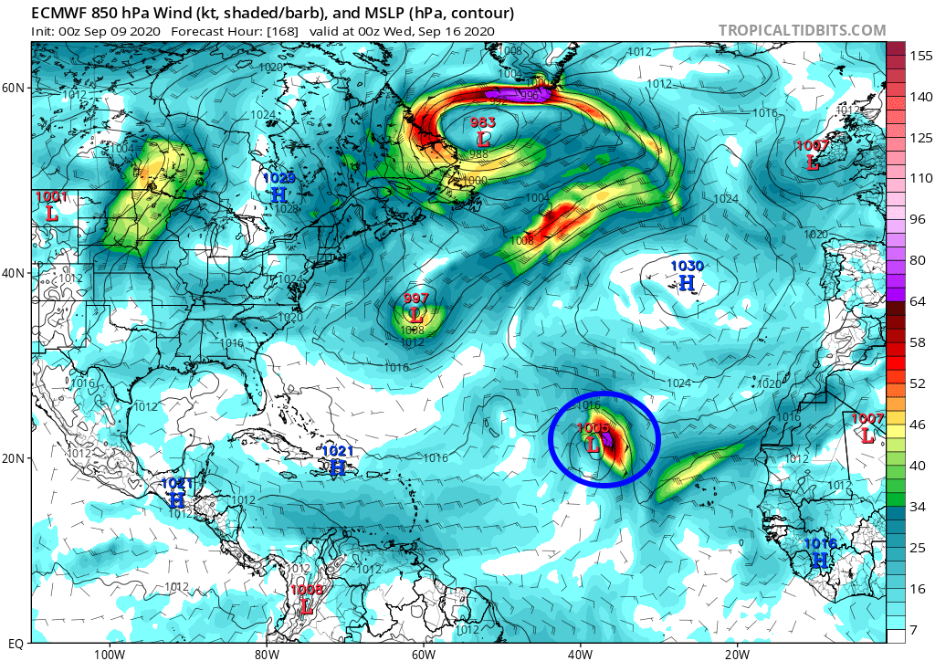
Forecast from 9/9 at 00h
We can clearly see that there is no consistency in these forecasts, which were released at 4-day intervals, and that there is therefore no relevance. Unfortunately, the most shared posts are those which show the most threatening forecast for the West Indian region when it is largely in the minority.
Why so much uncertainty
This very pronounced uncertainty is due in large part to 3 variables:
- The length of the term. As I indicated above, 200h is too long a deadline for a hurricane forecast. The only thing that we can look at is if a trend appears (similar forecast over several days) or a consensus is formed between several models (at this time there is only theECMWF extension, GFS and CMC which present a tad of relevance).
- The extremely complex situation in the Atlantic. This situation is due to the presence of 2 cyclones over the tropical Atlantic (Paulette and Rene) and the rapid circulation of several depressions over the northern ocean. The conjunction of the 2 creates significant constraints on the anticyclone and therefore faster movements of the latter than in normal times. And that, the models have a lot of trouble to predict at this time.
- The disturbance is not yet in the Atlantic. The fact that it is not yet on the water is a major handicap for the forecasts because the passage from land to ocean often generates large evolutions in convection and can also create important trajectory artifacts.
What to expect
As you have understood, the complexity of the situation in the Atlantic and the timing of the phenomenon prevent any forecast for the moment. Once again, we touch on the issue of making raw information publicly available (output from long-term models) which requires appraisal before drawing conclusions.
There is currently no trend emerging from the runs of the last 4 days. The trajectory forecast is constantly evolving in a very radical manner, which indicates that the model cannot read the situation and that therefore its forecasts at an instant T are completely hazardous.
There is also no consensus between the 3 models that have capabilities at this time. They each give each run different trajectories and intensities.
It is therefore impossible today to determine the level of risk weighing on the West Indies for this system. The only thing that seems fairly certain is that it should strengthen quite quickly once on the Atlantic. Then it is for the moment the most total blur and anyone who says anything else is lying!
Conclusion
As I always do in these times of deep concern and forecast uncertainty, I advise you to watch ONLY the nhc. They are content to give information on acceptable deadlines and do not leave with far-fetched 8-day forecasts. For the moment they predict that a system will come out of Africa and that it has a high risk of cyclonic strengthening. That's good, that's all we know about probable.
Flee like the plague the catastrophic posts in this period. They offer no interest in terms of forecasting and only propagate fake-news intended to create buzz and sensationalism. There is nothing concrete and relevant in all of this, just uncontrolled assumptions of forecasting models overwhelmed by the complexity of forecasting.
To be informed live of new articles, you can subscribe to the Facebook group or to the account Twitter.
Image credits; Tropical tidbits, NHC / Noaa, UW-CIMSS

