Current cyclones and Watching


August 30, still rough weather in the Atlantic

Le 30 août 2020 à 10:00

By Olivier Tisserant
4.92/5 (126)

Reminder: the information and illustrations on this site are NOT INTENDED to protect property and people from cyclonic risks. For this, you must follow the information and recommendations of your prefecture for France and the competent authorities for other territories.

During the last point (Friday) I told you about the 3 waves on the Atlantic, 2 of which followed by the nhc. There are now 4, including 2 followed by the nhc plus another to arrive in the next few hours and already monitored. There is also an area of ​​low pressure near Florida. At the moment, none of the 4 waves on the MDR threatens to strengthen in the short term, the nhc having even reduced the risk on one of those he was following. However, the high water temperature in the Atlantic makes it necessary to follow these disturbances even if for the moment the conditions are not too favorable for a cyclonic development.

We continue to advance towards the statistical peak of the hurricane season (mid September) and this agitation is logical. It should also last for some time given the areas of intense convection which circulate over western Africa and which end in the ocean. We are entering the hard part of the season and from now on it is mainly a question of luck, beyond any statistical consideration. A wave in the wrong place and at the wrong time can quickly become a serious threat ... but it almost always plays out at very little: a few degrees of longitude or latitude more or less which bring closer or further from the shear, a few hours earlier or later that change the environment… etc.

The wave on the West Indies

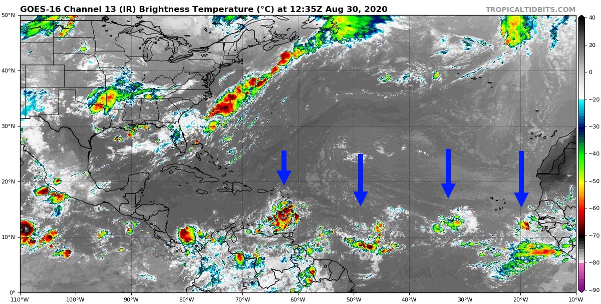
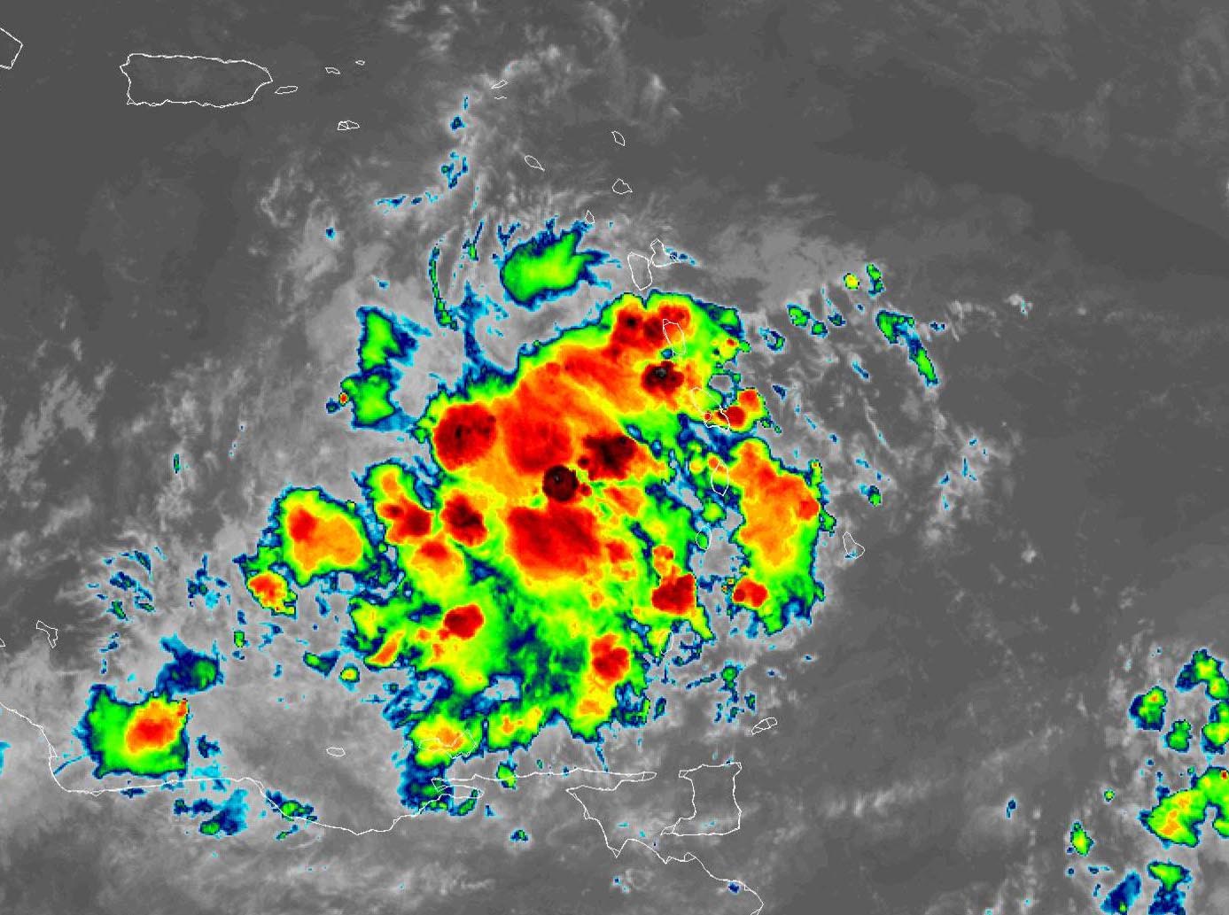
It has brought a lot of rain since yesterday, especially in the center of the arc (from Saint-Vincent to Guadeloupe). A good part of the convection is now in the Caribbean but there are still a lot of convective hotplates around the islands and it continues to bud quite a bit this morning. Martinique and Guadeloupe are still on YELLOW Watching for heavy rains and thunderstorms and the day could still be quite wet. The nhc placed it in Invest this morning (99L).
 

Arc Antillais satellite image - 30/08/2020 - 12h UTC
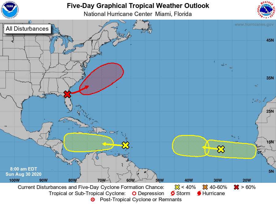
For the moment the major global models (ECMWF extension et GFS) do not develop it in the Caribbean but the CMC et ICON begin to identify a depression approaching Central America. These models being much less efficient than the first 2, this remains a hypothesis not yet very relevant. For the moment no Laura-style scenario in sight and that's good news.

The 3 waves in the Atlantic

The first is between 40 and 50W. It is not monitored by the nhc and they don't even mention it in their Outlook newsletter. It does not present a risk for the moment with weak convection and very weak vorticity. She moves W to 15 kts and should interest the West Indies from Tuesday.

The second is around 30W. It is the one that the nhc has been following for several days. He lowered his reinforcement risk to 30% in 5 days after increasing it to 40% in recent hours. Its very slow movement makes it quite difficult to predict the West Indies since it could take a good week to get there at this pace. Its convection is not very important and it has no organization currently. The global models are unanimous this time around and no one develops it before the West Indies. But given its slow speed, nothing can be taken for granted.

The last is located between Cape Verde and the African coast, quite to the south. It is a disturbed area that has just arrived on the ocean from the coast. At this longitude it is still difficult to anticipate an evolution and we do not know how it will be organized in this humid environment. It should be noted that it is not she who is monitored by the nhc most easterly.

A new disturbed area (it leaves 1 to 2 a day at the moment) is scheduled to come out a little later, and it is this which is supervised.

Just a quick note to talk about the low pressure area over Florida which should be classified as a low fairly quickly: it shouldn't be inland and is slated to pass well off Bermuda for the time being.

Conclusion

We are now in the hard part of the season. A simple look at satellite images of the Atlantic and at the maps of the nhc is enough to realize it.

For the moment, this agitation does not cause a clearly identified risk for the West Indian region or the other territories. We can be happy about this, but without losing sight of the fact that at this part of the season the forecasts can change very quickly… even in a few hours. Caution and preparation are therefore required for a full month now and daily monitoring of the situation is now necessary given the significant atmospheric unrest in the tropical Atlantic.

To be informed live of new articles, you can subscribe to the Facebook group or to the account Twitter.


Image credits; Tropical tidbits, NHC / Noaa, UW-CIMSS

Please rate this item

Comments

Subscribe
Notification for
guest
0 Comments
Online comments
Show all comments

Translations are automated.

Current cyclones and Watching


Latest videos

ATTE

Disclaimer

TION

This site has been developed for entertainment and understanding the weather in the tropics.

It should only be used NEVER for the safety of people or property.

Only information from your national meteorological service and your civil security should be used in case of proven risk!

Account

Login

[user_registration_my_account]