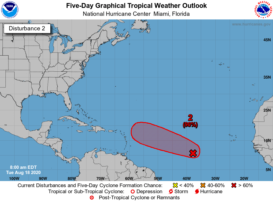
The predictions of the models on the situation of high and low pressures in the Atlantic continue to put forward the hypothesis that I presented last night, namely a zone of high pressure (dorsal) which forces the displacement of 98L between the W and the WNW, which would bring it to or near the north of the arc. All the trajectory tracking models seem to follow this option, with a good consensus that is forming for this possible trajectory. It should require people who live and navigate in this area to be very careful and careful.
Regarding the intensity, we find the traditional big gap (which I was talking about last night too) following a ranking in Invest. But this time around, the majority of forecasts remain reasonable with a low intensity system at the longitude of the arc. One of the only ones to leave on a somewhat apocalyptic forecast is, as often the model HWRF dedicated to tracking which announces 965 hPa on the north of the arc in his midnight run. But do not pay too much attention, he is one of the biggest victims of classification bias!
So, overall, we are on a consensus for a passage to the north of the arc or to its immediate north for a system that could be a good low or a storm. It's rather reassuring for once.
However, it should be kept in mind that we are in a VERY particular configuration, with 2 extremely similar disturbances and the models are not specially adapted to respond to this rather rare problem of interaction in a favorable environment. In this situation a consensus of intensity has less value than in the case of a single well identified and isolated system. Caution and Watching must therefore remain in the north of the arc until the passage, as this type of system can prove not very docile to predict.

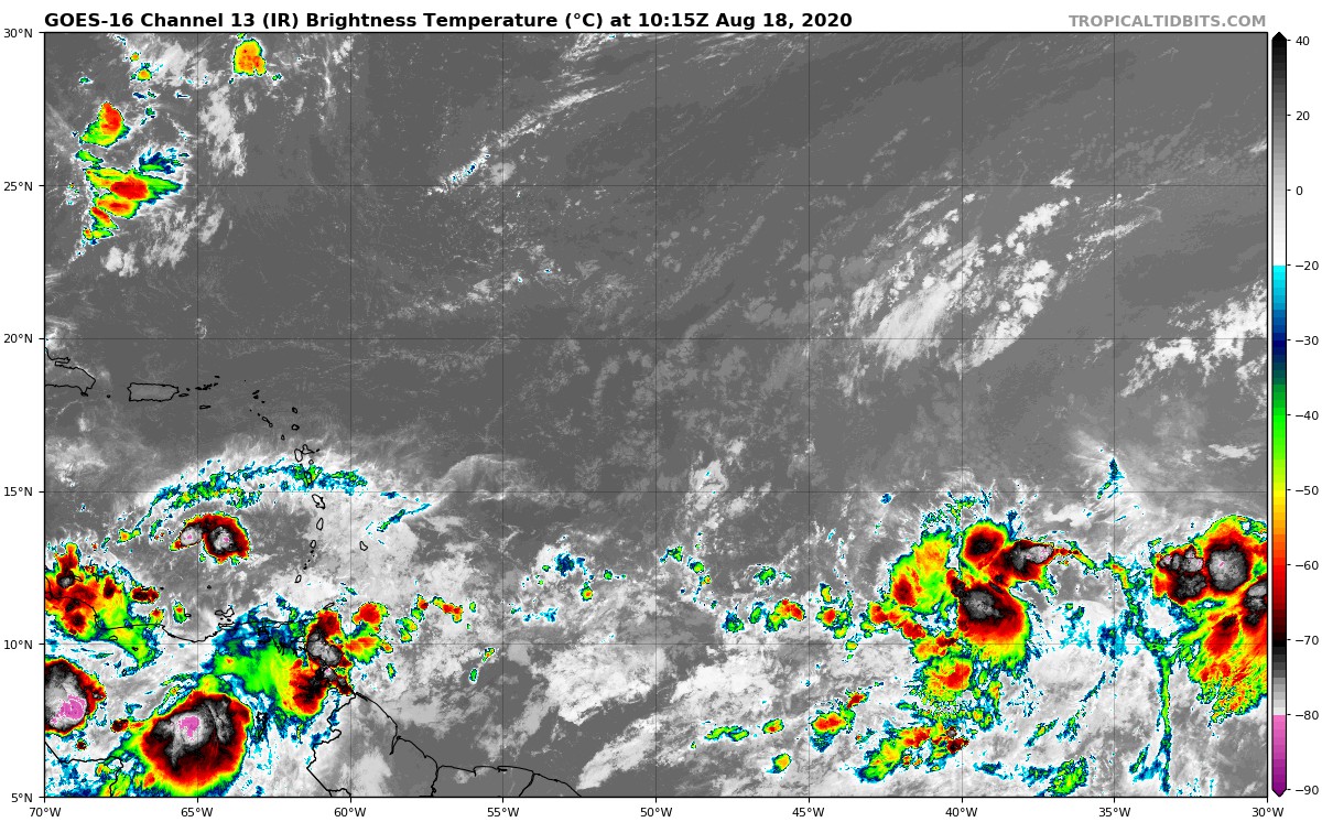
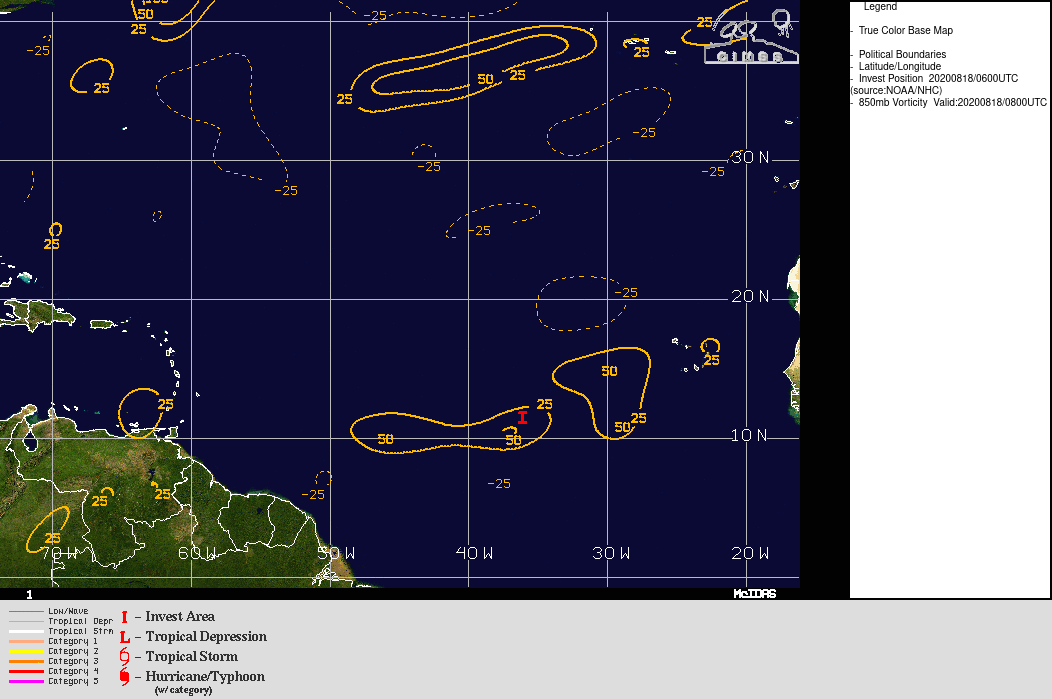 We always clearly see on satellite wind analyzes the presence of 2 distinct traffic zones, each linked to a disturbance. The proximity of these 2 systems makes their organization very difficult if they do not merge; which is currently not the case. And given the fairly fast movement speed (around 15 kts), every hour saved is important.