Current cyclones and Watching


Invest 92L # 6 - July 29, 2020 - 4H00 UTC

Le 29 juillet 2020 à 2:30

By Olivier Tisserant
4.87/5 (45)

Reminder: the information and illustrations on this site are NOT INTENDED to protect property and people from cyclonic risks. For this, you must follow the information and recommendations of your prefecture for France and the competent authorities for other territories.

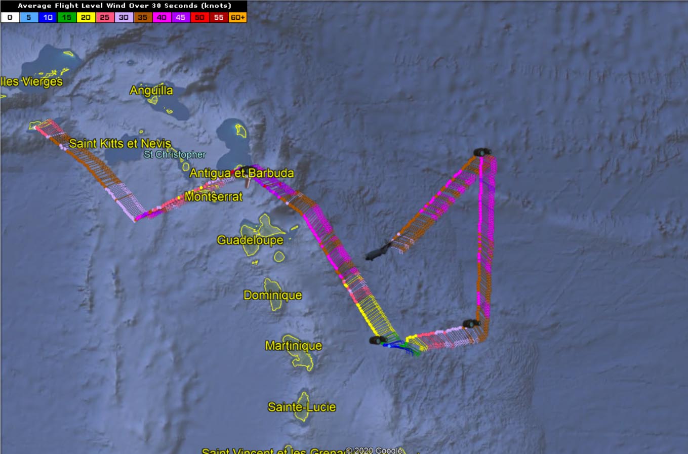
The disturbance that shakes the West Indies, called “Potential Cyclone # 9” has started to impact the islands. It still looks very poorly organized on radar and satellite images, but a Hurricane Hunter tries to find a center and closed traffic, which would classify it as a storm.
For the moment, a very large convective zone has affected the middle of the arc between Saint-Vincent and Dominica. Strong accumulations of rainfalls were recorded on the 4 islands and in particular in Martinique with nearly 100mm in places. The thunderstorms were very marked with numerous lightning strikes on the area.


The area of ​​strong wind north of the system is just beginning to arrive over the northern half of the arc. Désirade airport begins to register wind at 30/35 kts and the second part of the night and the day could be very windy between Guadeloupe and the Northern Islands.
 

The last bulletin of nhc is extremely evasive. For 3 days they have been anticipating an improvement in conditions and therefore an organization that does not come and they are therefore very careful. The Hunter being investigated finds a lot of wind off Guadeloupe and Dominica but it is still early to try to understand the organization (if it exists!) Of this system from his data. He spotted an area of ​​calm off Martinique that could be a possible center (or at least part of it) with surface pressure in the order of 1008 hPa which remains high for an organized storm.

Some of the convection still seems to have passed by this time. There are now a lot of isolated squalls and especially the area of ​​strong wind north of the estimated center which should affect the northern half of the arc much of the day.


To follow the live quantified evolution of # 09, it is HERE.


Please rate this item

Comments

Subscribe
Notification for
guest
1 Comments
The oldest
Most recent The most popular
Online comments
Show all comments
trackback

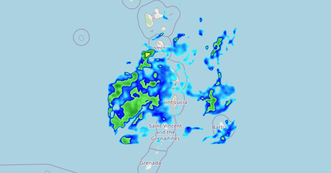
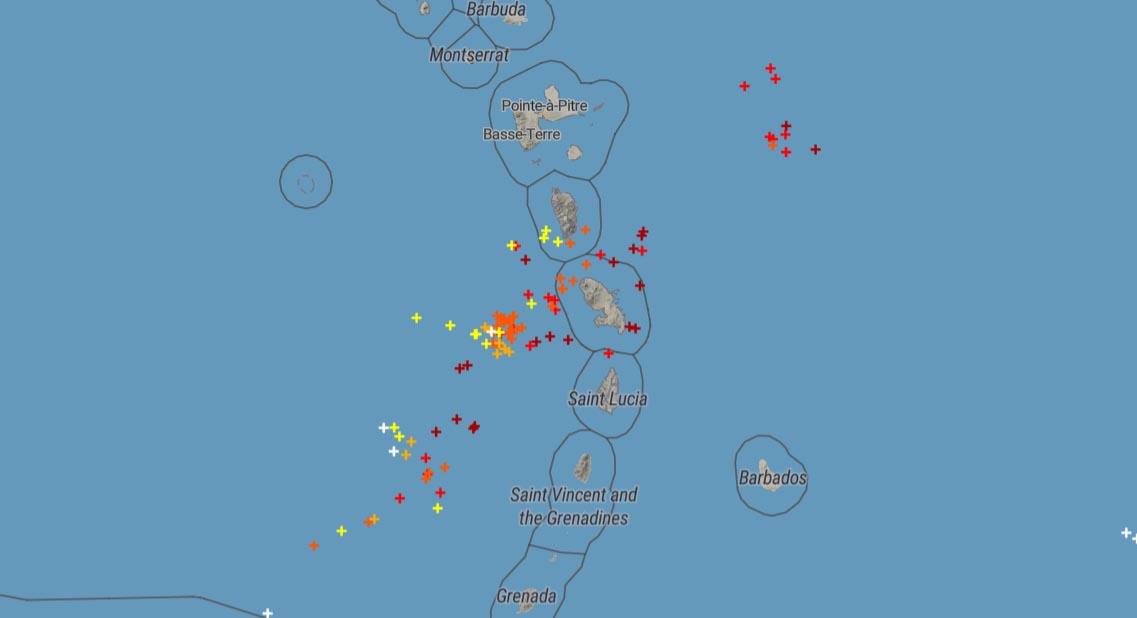
[…] In places. The thunderstorms were very marked with numerous lightning strikes on the area. Read more on the Météo Tropicale website HERE Comment with your account […]

Translations are automated.

Current cyclones and Watching


Latest videos

ATTE

Disclaimer

TION

This site has been developed for entertainment and understanding the weather in the tropics.

It should only be used NEVER for the safety of people or property.

Only information from your national meteorological service and your civil security should be used in case of proven risk!

Account

Login

[user_registration_my_account]