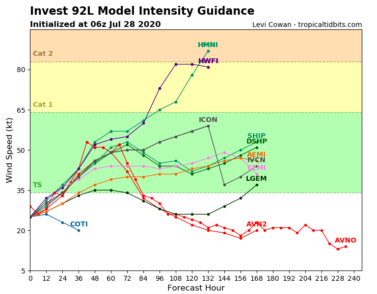
In terms of intensity, the specialized models have gone all over the place for the next few days. Some have taken their forecast upwards but none foresees a hurricane before the passage over the West Indies. Overall, at 36 hours due, they almost all see a system between the depression and the tropical storm.
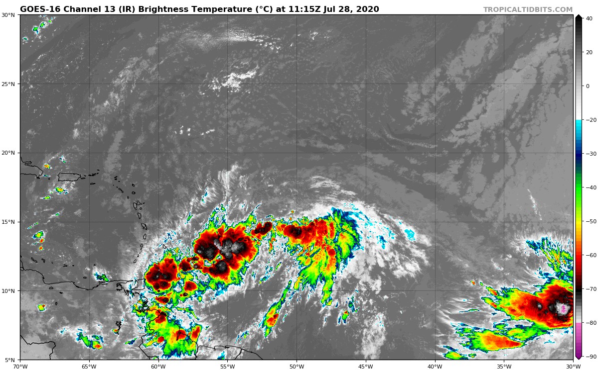
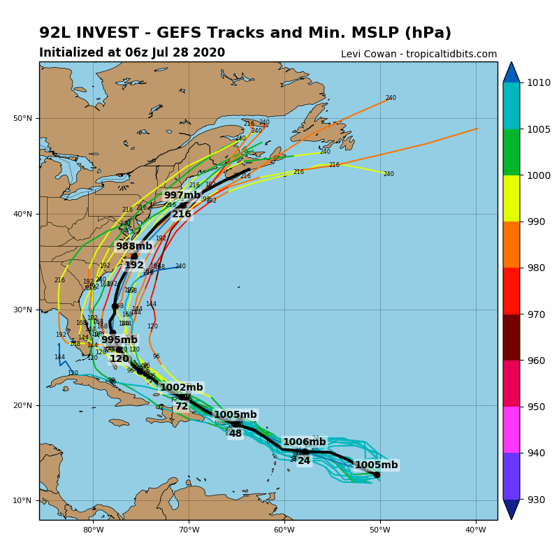
As for the trajectory, the consensus for the northern half remains in place but it doesn't mean much because of the extent of the disruption and its failing organization. The entire West Indies must be prepared to receive rain, wind and heavy seas. The remaining question is that of the change in the winds to the West, but we will have to wait for the data from the plane to find out what really is.