4.91/5 (79)
Reminder: the information and illustrations on this site are NOT INTENDED to protect property and people from cyclonic risks. For this, you must follow the information and recommendations of your prefecture for France and the competent authorities for other territories.
Despite its classification as a “potential cyclone”, the disturbance on the approach to the West Indies does not seem visually better organized than this morning. But its proximity to the land and the wind records prompted it to be classified in order to trigger warning procedures on the islands concerned. However, despite a fairly limited organization, the convection has undergone a significant evolution today which could lead it to strengthen a little in the coming hours.
A Hurricane Hunter is under investigation to try to determine if a hurricane organization is present with closed traffic and attempt to locate an elusive “center”. And above all to obtain a mapping of the wind in the different quadrants.
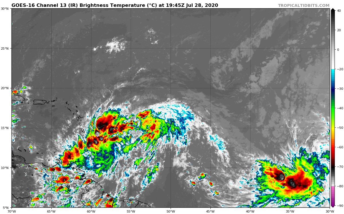
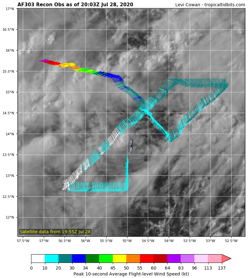
In its latest bulletin, the nhc anticipates a storm classification at the end of the Hunter's investigation, ie before passing over the arc. But ultimately it does not have a great importance since the wind is already in places of the storm level with 35 kts. So whether it stays in a potential cyclone or turns into a storm, with its proximity to the West Indies, that won't change much.
It's the same for the trajectory. This is a very extensive system that will affect the entire West Indies to varying degrees. But the strongest recorded winds at the moment, around 35 kts at the surface, is located mainly to its north.
For the moment, the Hurricane Hunter has found neither a center nor closed traffic. We are therefore dealing with a system which has the wind and convection of a storm… but which is not!
Anyway and whatever its ranking at the end of the Hunter's mission, we know several things:
- The entire West Indies is affected by rain and thunderstorms
- The north of the arc will be more impacted by the wind
- Sustained winds are around 35 kts with gusts of 50 kts
- The risk of a hurricane is extremely low (and that's my legendary caution speaking!)
- The sea will be heavy over a large northern half of the arc (not to say 2/3)
What we do not know yet:
- If there is a risk of the wind shifting to the west. When in doubt, boaters must take preventive measures
The first impacts have already started in the southern half of the arc and the passage will continue until tomorrow evening. Be careful and vigilant, it may rain quite a bit and the gusts could be violent.
To follow the live quantified evolution of # 09, it is HERE.
Image credits; Tropical tidbits, NHC / Noaa, UW-CIMSS