
 While we are attacking the big statistical peak of the hurricane season, the 2 systems that have interested the West Indies in recent days are, for the first (storm Marco) on the coast of Louisiana and for the second (storm Laura) on western Cuba. The latter is expected to hit the American coast of Texas or Louisiana on Wednesday or Thursday in a Category 2 hurricane at least.
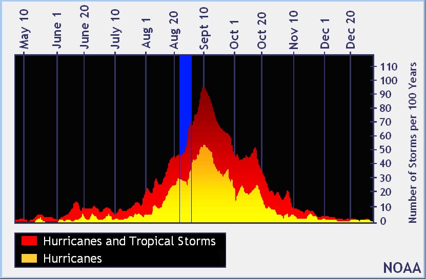
Statistically this 13th week has seen the birth of 82 cyclones since 1950, 12 of which have affected the West Indies.
,
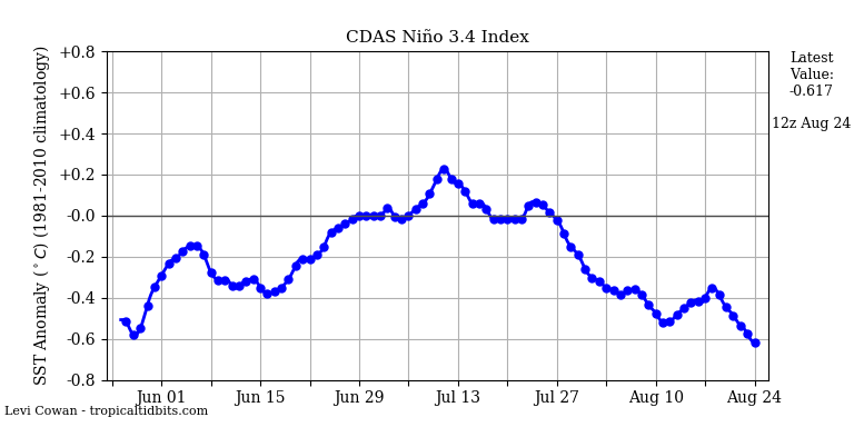 Oscillation ENSO sinks a little deeper into the cold zone and slowly approaches a phase La Nina. The forecast nevertheless remains favorable to maintaining a cold neutral phase for the coming weeks. And given the inertia of the conditions linked to this global oscillation, a change in the coming weeks should not have big consequences for this season which is expected to be very active anyway.
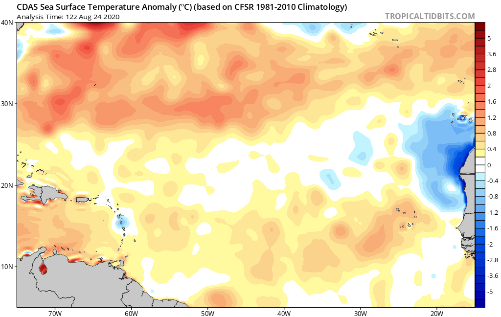 Water temperature anomalies are turning positive across the tropical Atlantic. An area with near-average temperatures persists under the mists of sand.
This data has less relevance today. The raw temperature is now hot (between 27 and 29 °) everywhere on the MDR and differences of 0,5 ° are not very significant. On the other hand, the temperature must be monitored when approaching the arc. A passage at 30 ° or more would give a high risk of rapid reinforcement in the vicinity. We are currently at 29 °, which is already high.
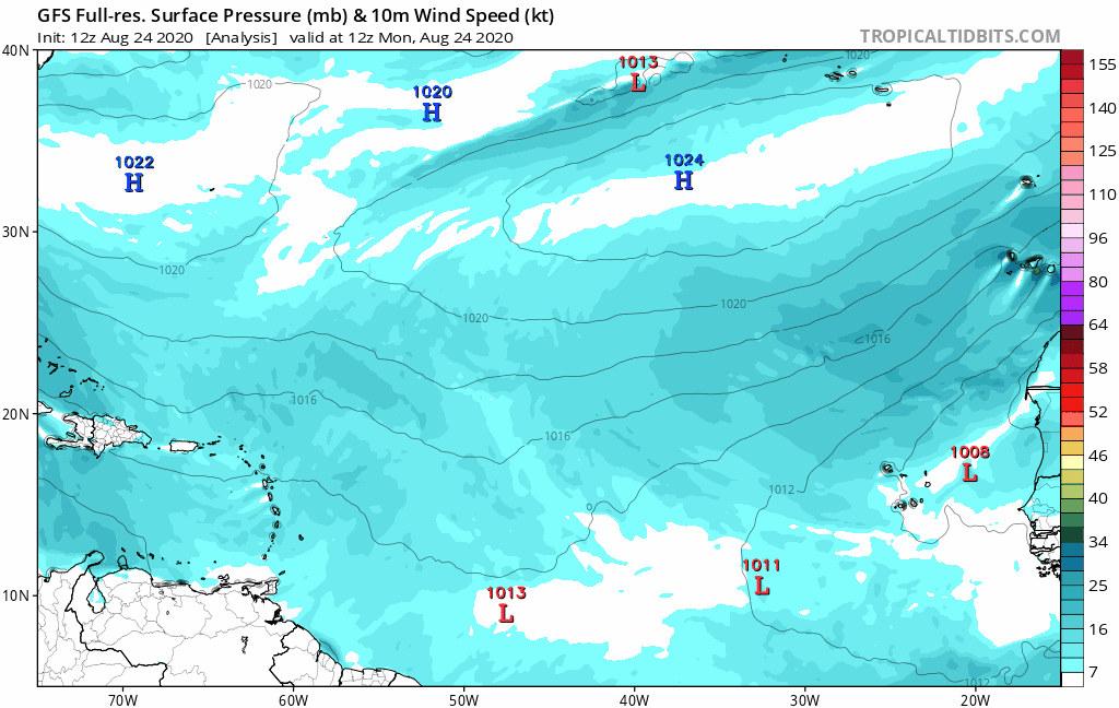
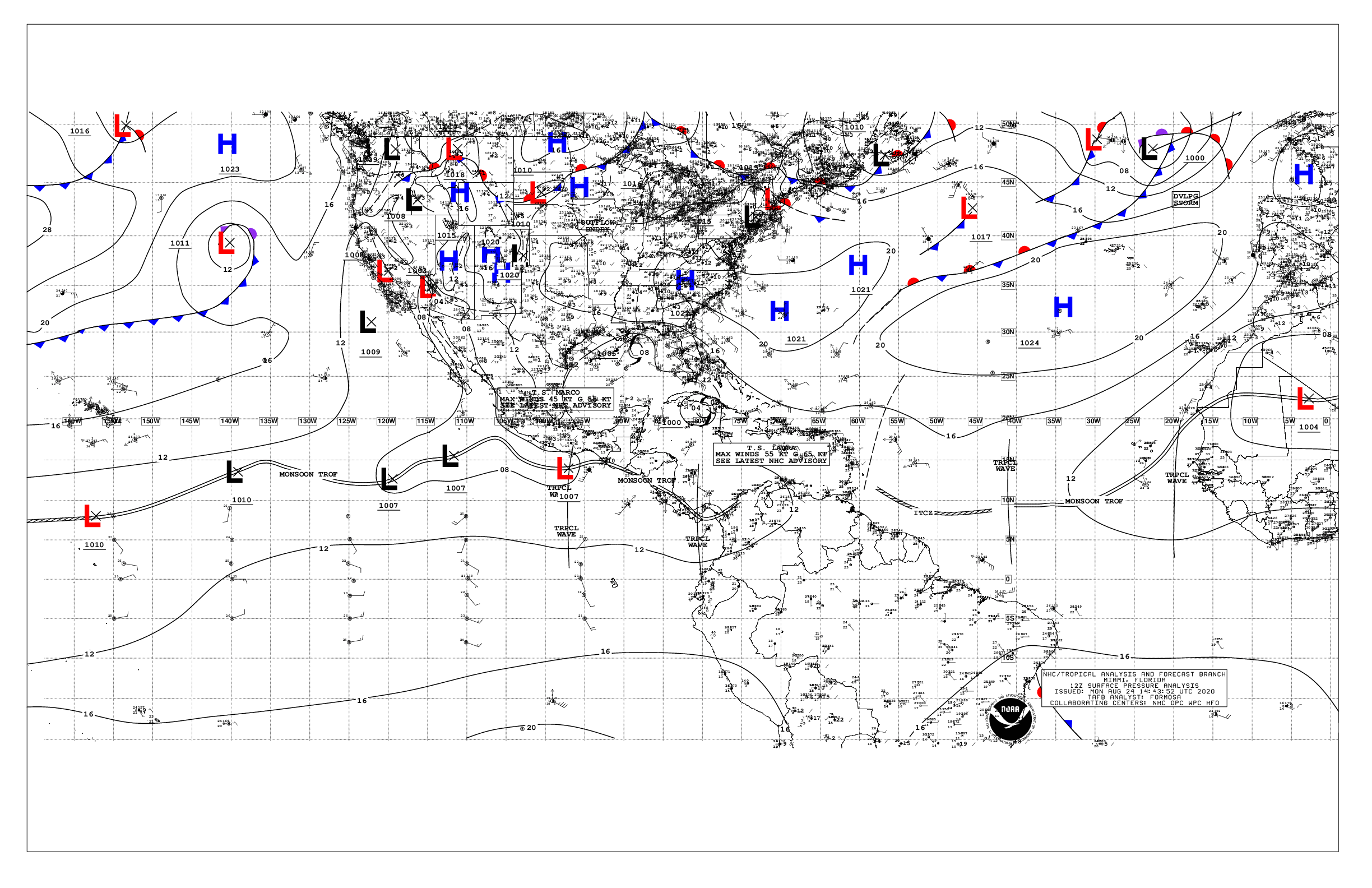 The pressure map indicates the presence of areas of high pressure throughout the northern tropical Atlantic, which explains the very western trajectory of storm Laura. The ITCZ is around 10N and isobar 1016 hPa close to 20N. The situation is expected to be maintained overall at 48 hours.
2 Waves are circulating on the Atlantic and are not threatening for the moment. the first out of Africa and the second halfway with the West Indies.
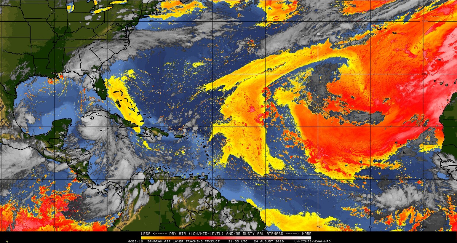 There is still quite a bit of dust and dry air over the eastern tropical Atlantic. It is rather good news for the days to come since it will move towards the West and protect a little the approach of the arc.
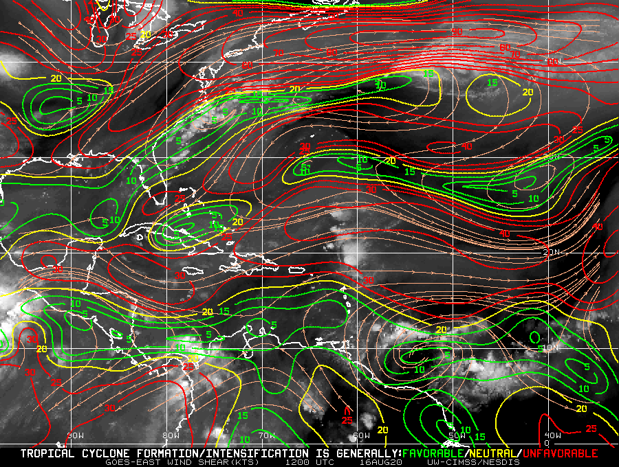 Le shear remains contrasted in the major development zone and generally quite present. This is partly what explains why the wave leaving Africa resisted very badly when it arrived on the ocean.
Le GFS predicts that hostile conditions will continue over the eastern tropical Atlantic for the next 3 days.
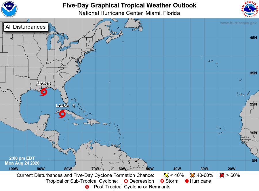 Apart from the 2 storms mentioned above the nhc does not plan anything on the Atlantic for the next 5 days. It feels good to breathe a little even if nothing is ever written in this area!
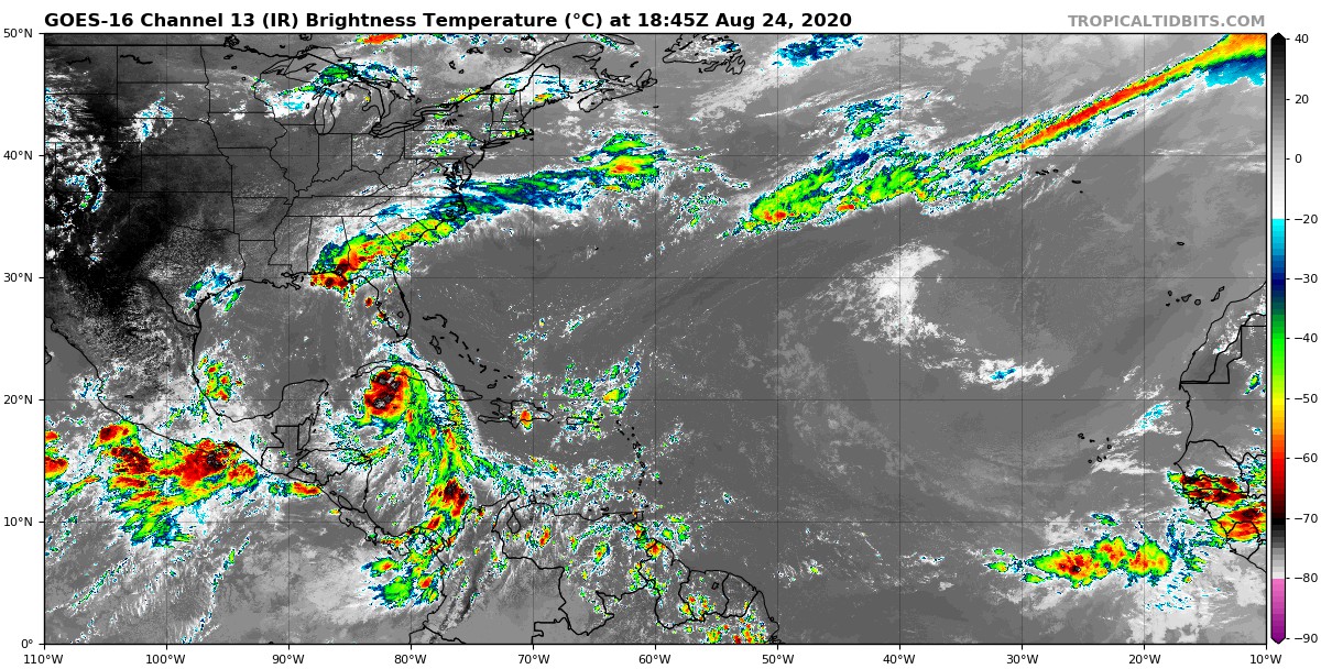 Not much to note about the major development area. The western half of the major development zone is even strangely dry for the season. The next few days should therefore be calm!

