
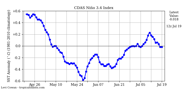
 Oscillation ENSO always remains in neutral phase with variations in cold and hot zones. At the moment there is no change from the seasonal forecast.
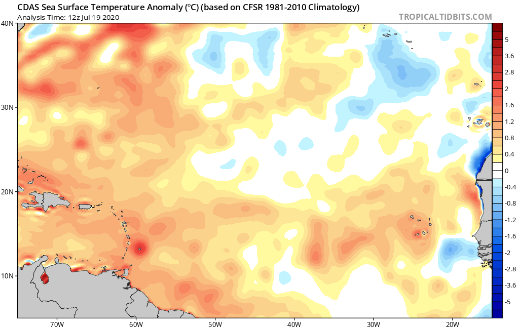 After having greatly benefited from the impact of the sand mist which limited the warming of the water for several weeks, water temperature anomalies in the Atlantic started to rise again last week. We are now in generally positive anomalies in the major development zone. This is not a very bad news insofar as it was largely anticipated in the seasonal forecast but it could possible start the starting signal of the season.
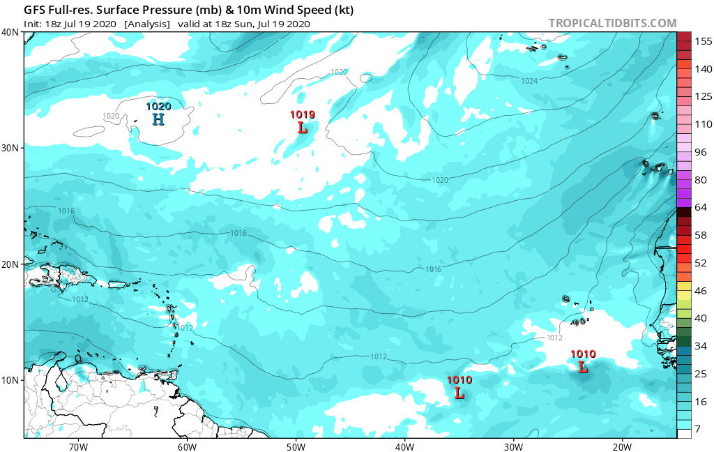
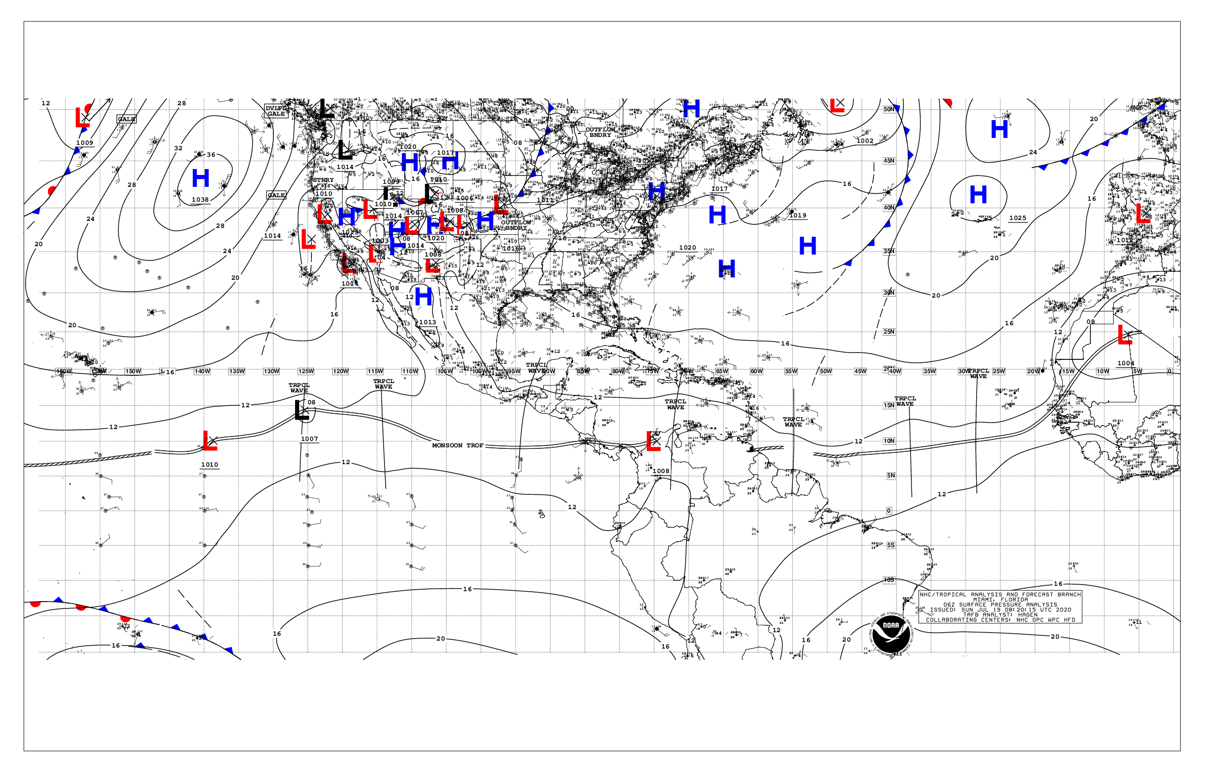 A very large area of high pressure covers much of the North Atlantic. But this zone is quite diffuse with a low pressure (1025 hPa at the highest) this puts the major development zone around isobar 1012/1014 hPa. The waves can therefore circulate a little further north than in recent weeks and find a slightly more favorable environment.
3 waves circulate on the Atlantic. The ones in the West and the East are not active or organized enough to threaten the arc. The one around 40W and 8N should be monitored a little more closely. A global model (CMC) predicts a little strengthening and the GEFS ensemble also sees a little something in the coming days.
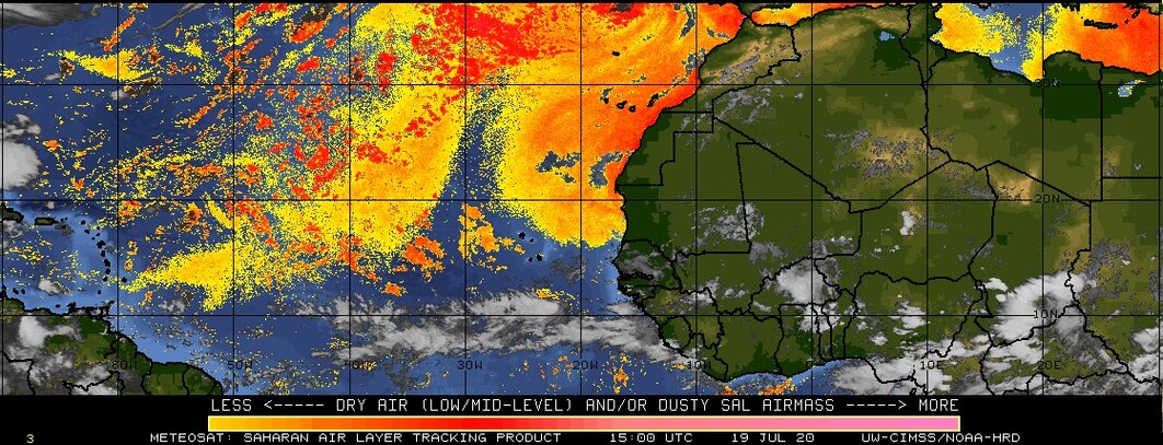 After having largely invaded the tropical Atlantic for several weeks, the haze of sand and the dry air slipped slightly to the north with less density, thus leaving a more humid atmosphere between 10 and 15N. For the moment we are still enjoying the protection of this dry air a little, but it is less marked than in recent weeks.
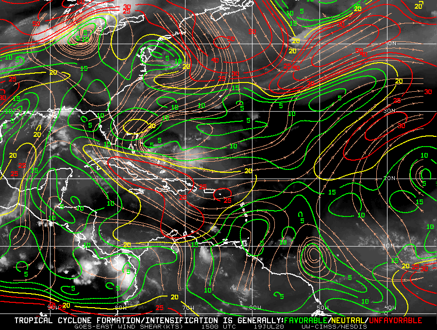 Unfortunately, the tendency to shear low on the major development area continues. With the warming of the water and the sand a little more diffuse, we find ourselves in conditions more favorable to cyclonic development than in recent weeks and we will have to be more vigilant on the waves circulating in the area.
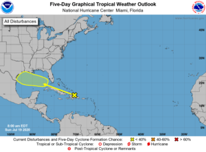 Le nhc monitors a wave a disturbance over the north of Hispaniola which could strengthen in the Gulf of Mexico.
For the moment there is nothing which concerns the West Indies directly.
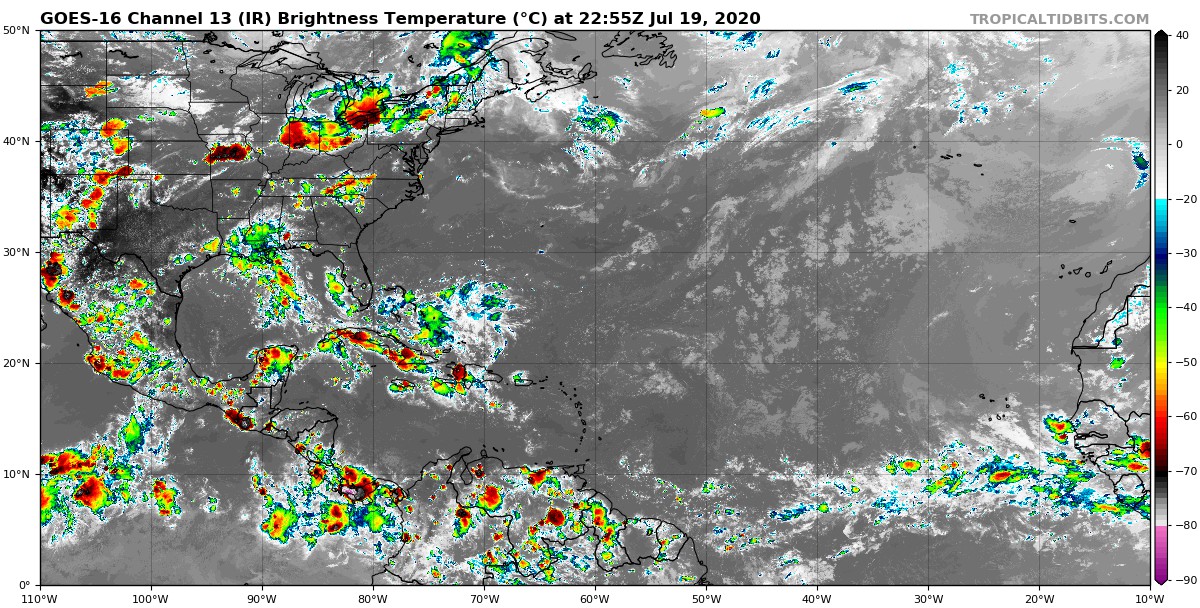 We can see the humidity which has risen to around 10N and the waves over the eastern Atlantic

