
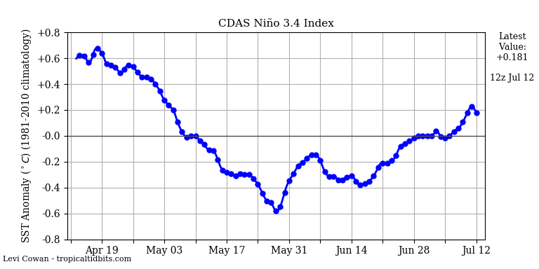
 Oscillation ENSO is returned to the slightly warm neutral phase. The longer the curve will stay away from the -0.5 ° zone, the better for the overall intensity of the season and especially its active part from August 15th.
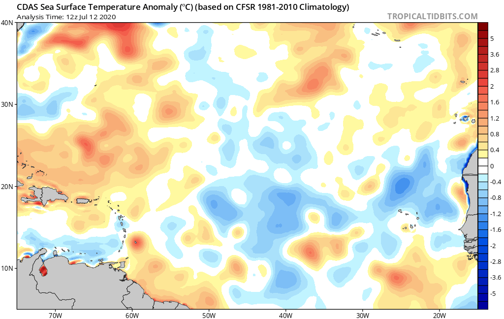 The water temperature anomalies in the Atlantic are generally negative in the major development zone. This is the effect of the thick haze of sand that has raged over the ocean for several weeks and which has blocked part of the solar radiation. Anything that can be caught in this area is good news for the next few weeks, especially if the haze lasts for a while.
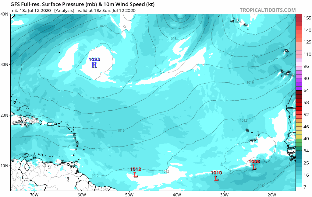
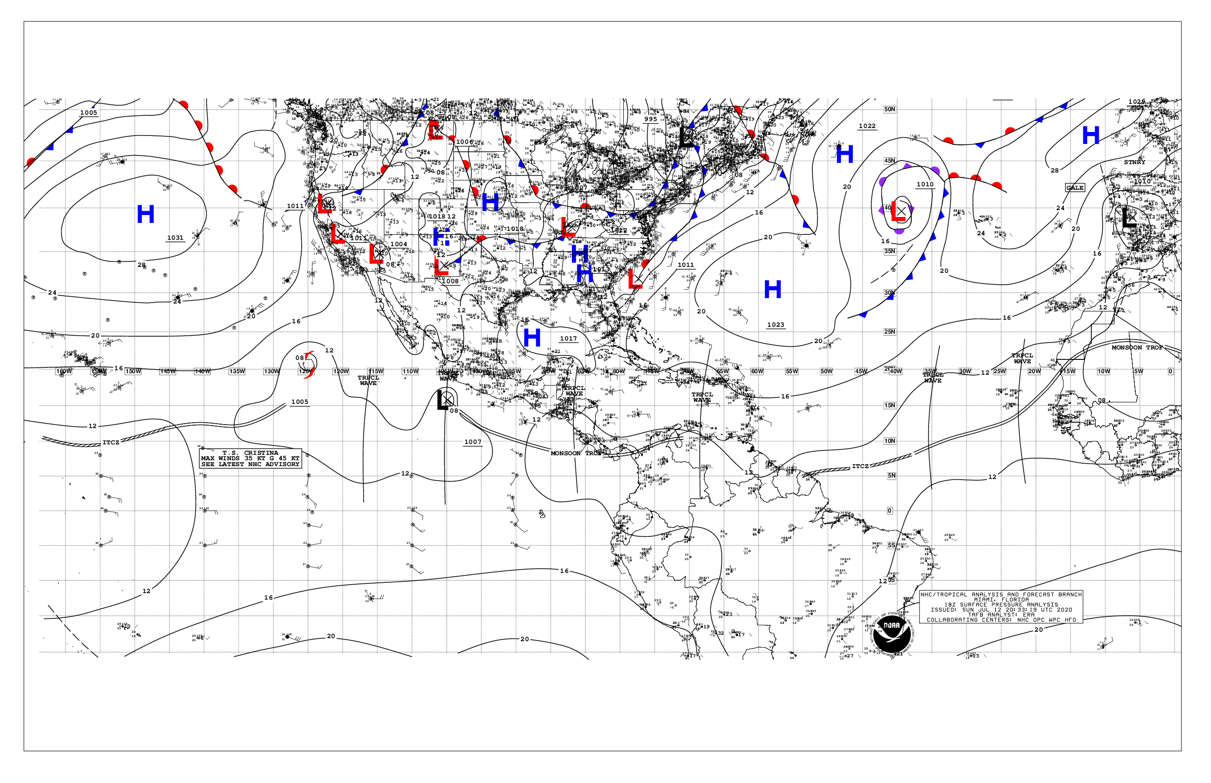 A depression over the Atlantic center has split the high into 2. The eastern part has moved up off France (and also brings very beautiful and warm weather) and the western half has slipped off the Bahamas.
Isobar 1016 hPa is therefore inclined on an NE-SW axis. The situation should not continue because it is a rather unfavorable configuration for the West Indies in terms of the trajectory of the weather systems.
La ITCZ follows the same trend with a very active zone near Africa and another very calm zone on the western half due to the haze of sand.
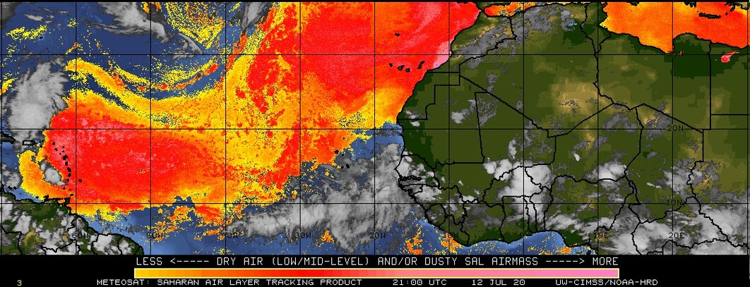 We came back to an episode of extremely dense sandy haze over the Atlantic and more particularly over the bow and offshore. It is very difficult for our respiratory tract but it protects us very well from the risk of cyclones. Cruel dillemne.
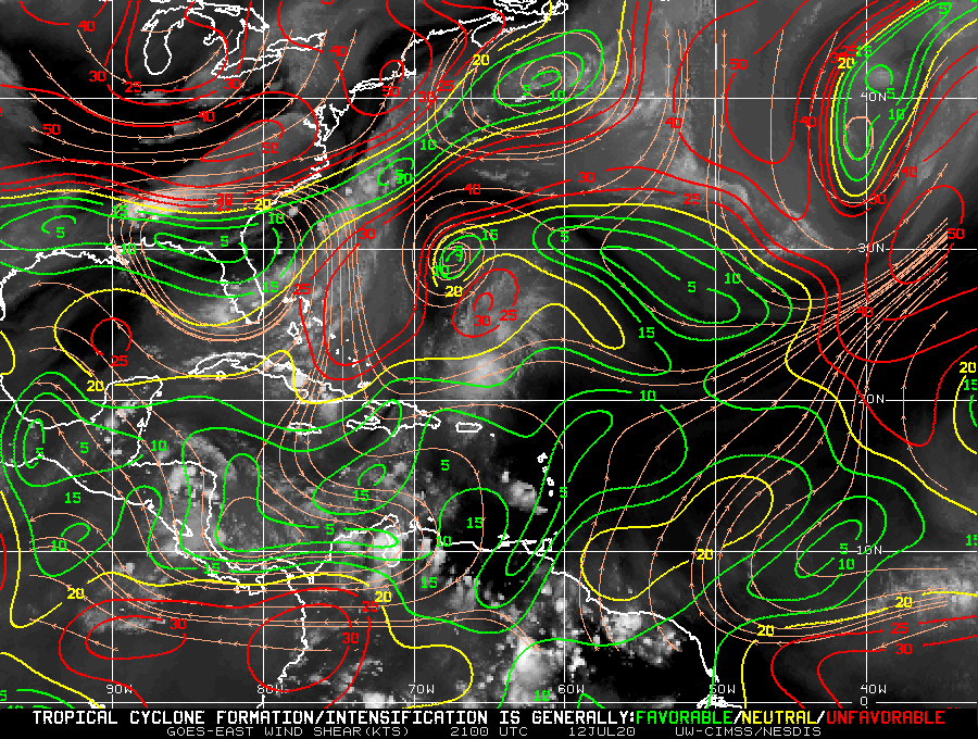 The tendency to weaken shear observed for 2 weeks has been confirmed in recent days. Windshears are now quite weak in the major development zone… which for the moment only leaves dust and dry air to maintain unfavorable conditions in the zone.
Despite this 3-week trend, the situation may improve again later in the season even if for the next few days the forecasts are not increasing.
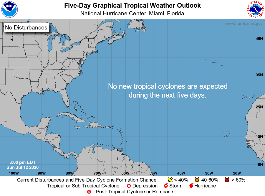 Le nhc does not plan anything on the Atlantic for the next 5 days.
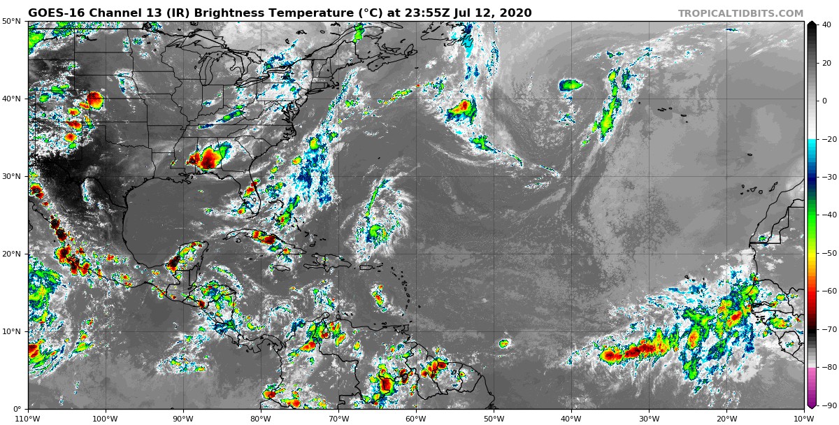 We can clearly see the NE-SW axis of the zone of dry air and high pressures over the Atlantic and the ITCZ very active on the eastern half of the ocean.

