The 2021 hurricane season, like that of 2020, started with a bang. We are not yet at the end of June and already 2 storms and 1 depression have marked the Atlantic basin.
Today we have 2 tropical waves which directly threaten the land:
- TheInvest 95L (1) SW of Cape Verde whose forecast trajectory passes over the northern half of the West Indies
- A wave (2) close to Bermuda which threatens Florida, Georgia and South Carolina
We will focus more specifically on theInvest 95L and try to see what is the risk for the West Indies with the current conditions.
Le nhc has been fairly undecided about this disturbance for 3 days. The risk evolves one way or the other with almost every bulletin in large part because of its high travel speed. For the moment it stands at 20% at 48 hours and 30% at 5 days.
Water temperature
In terms of conditions, the fact that we are very early in the season means that the temperature of the water in the Atlantic is not yet hot enough for a violent system to emerge before the West Indies. On the planned path of 95L, we see that the water temperature is between 24 and 27 ° which is still a little low to allow a significant reinforcement.
Shear
At the moment, 95L is in an area with a shear overall quite low. But there again, as early in the season, it remains strong above the West Indies due to a westerly wind flow at altitude (usual in this period) and the trade winds still present from the eastern sector at the level of the sea. This completely normal situation during this period makes it possible to protect the West Indies quite a bit from a major cyclonic reinforcement, even if there may be exceptions sometimes, such as the storm Chantal which passed in early July on the center of the arc in 2013.
Sand and dry air
Conclusion
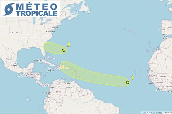
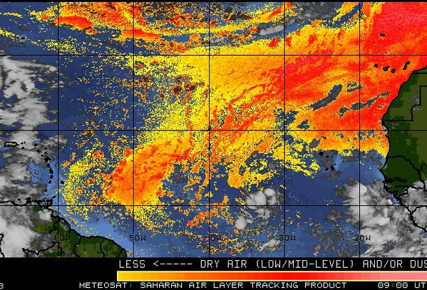
THEinvest 95L is currently in a moderately favorable environment for a small reinforcement. However, its high movement speed (between 15 and 20 kts) and the surrounding dry air are preventing it from being better organized at the moment.
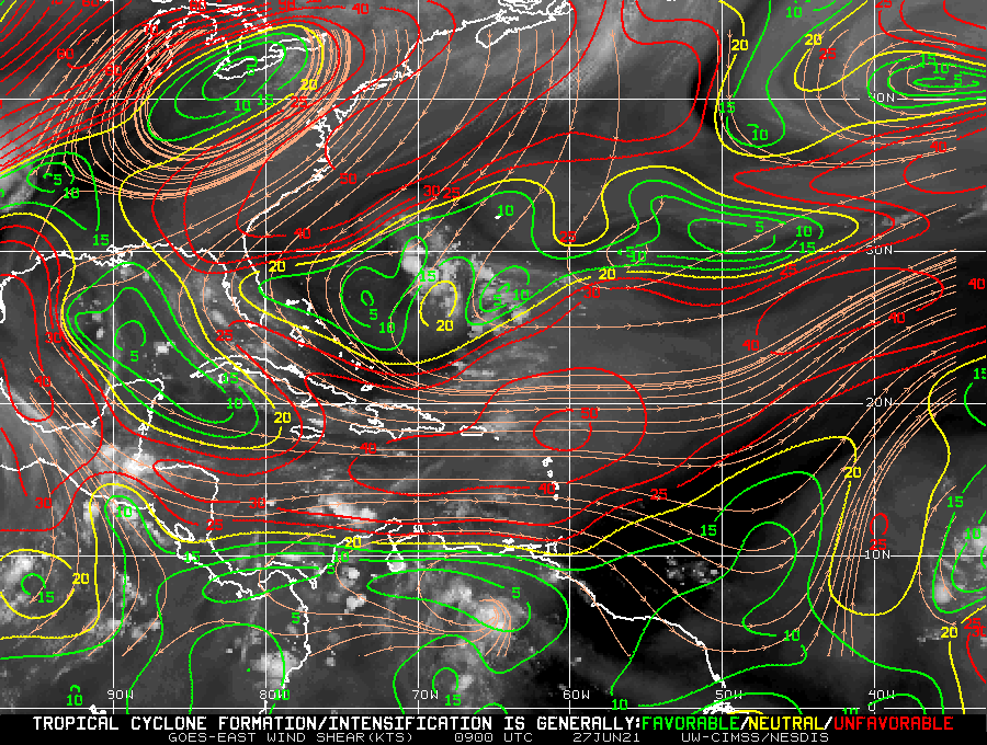
For the next few days he should meet a shear marked as it approaches the West Indies, which further limits the risk of reinforcement.
No global model develops this cyclone system for the moment. The greatest probability for the West Indies is the passage of a wave accompanied by good gusts of wind. If a development were to occur it should not go beyond the stage of depression given the current conditions and those expected for the next few days.
But as always, caution remains in order and the 5-day forecasts retain a significant amount of uncertainty. We are in a hurricane period and it is important to be vigilant and above all well prepared for cyclone risk.
Image credit: Tropical tidbits et UW-CIMSS