Reminder: the information and illustrations on this site are NOT INTENDED to protect property and people from cyclonic risks. For this, you must follow the information and recommendations of your prefecture for France and the competent authorities for other territories.
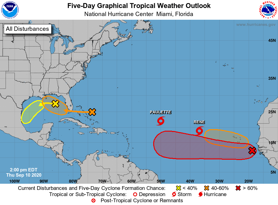
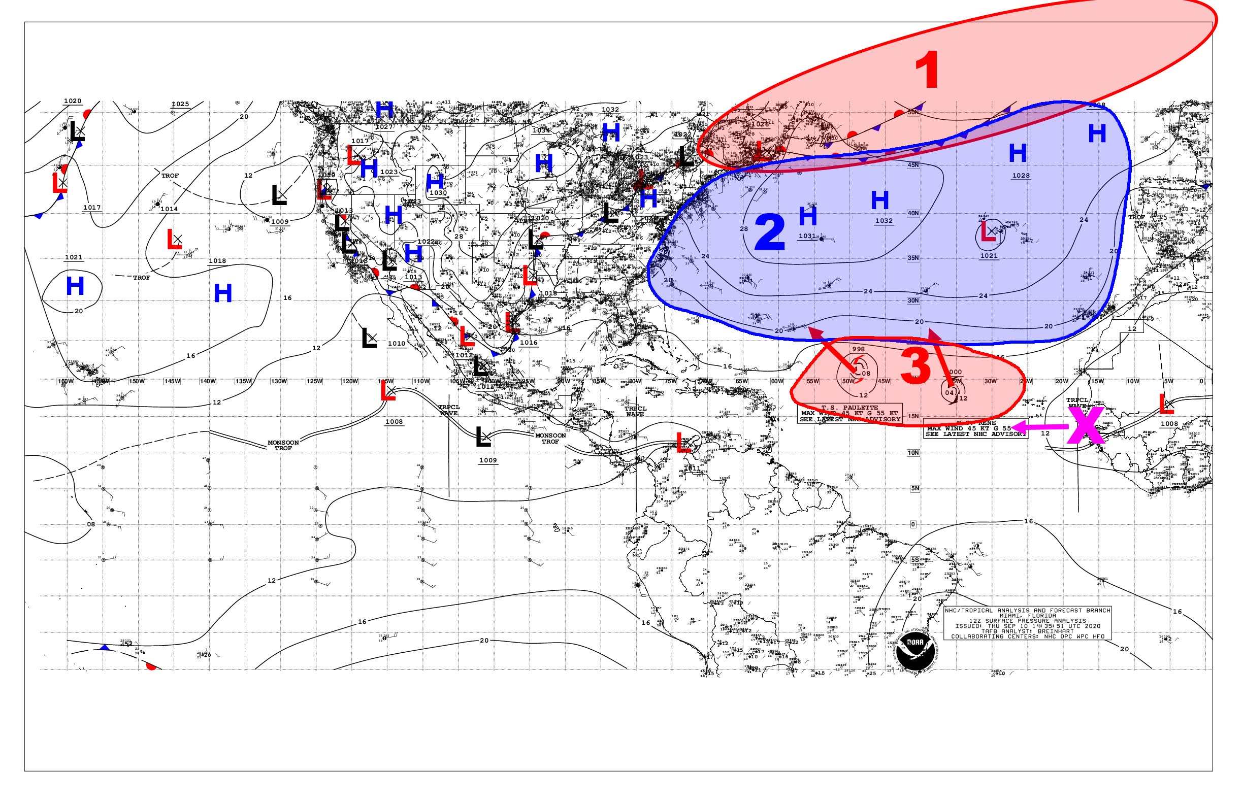
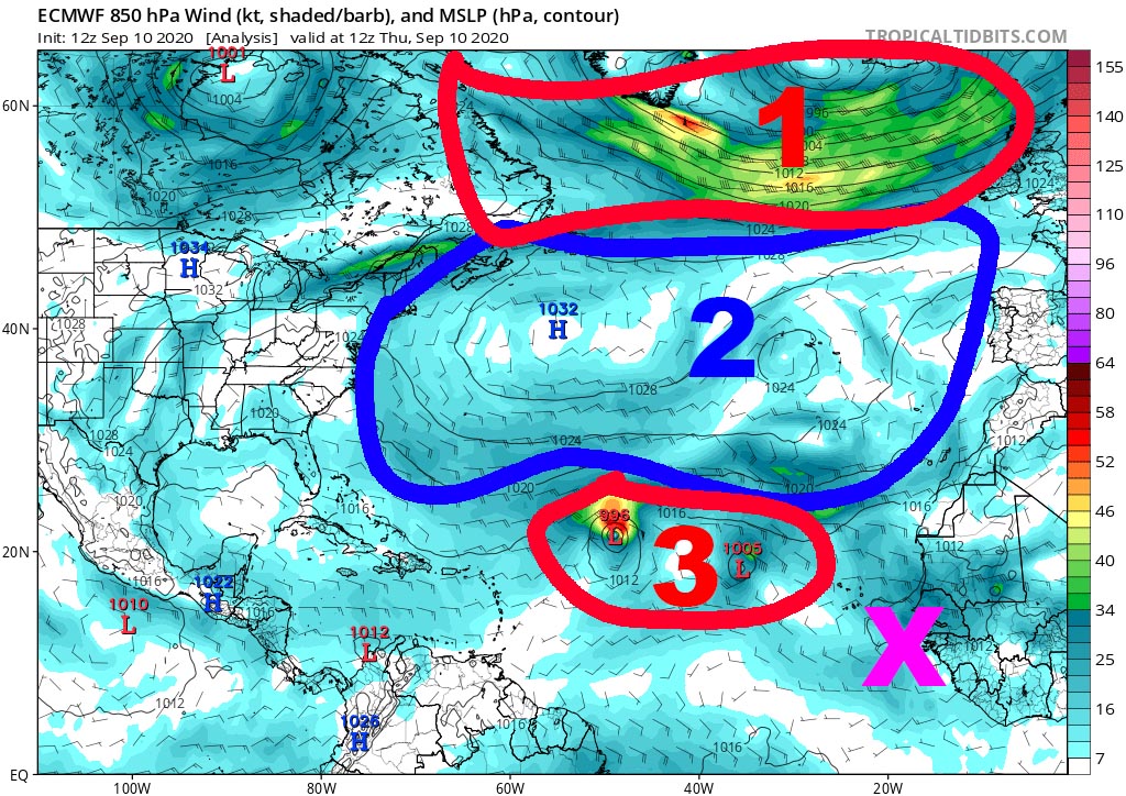
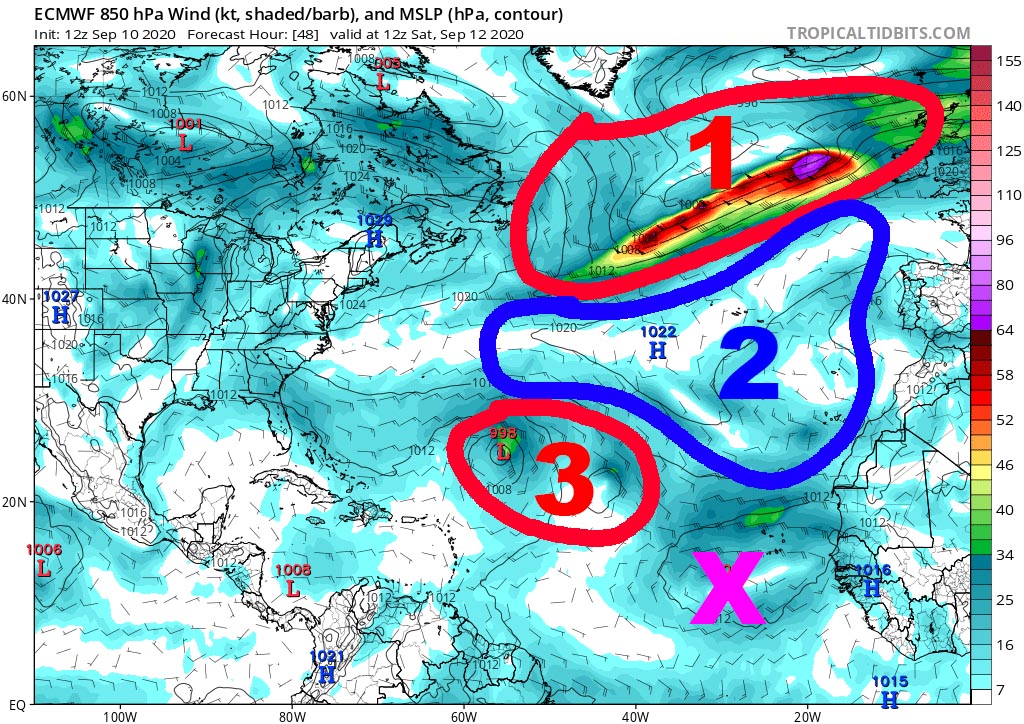
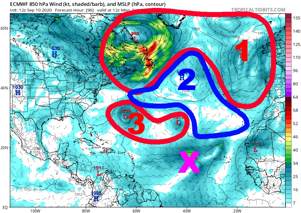
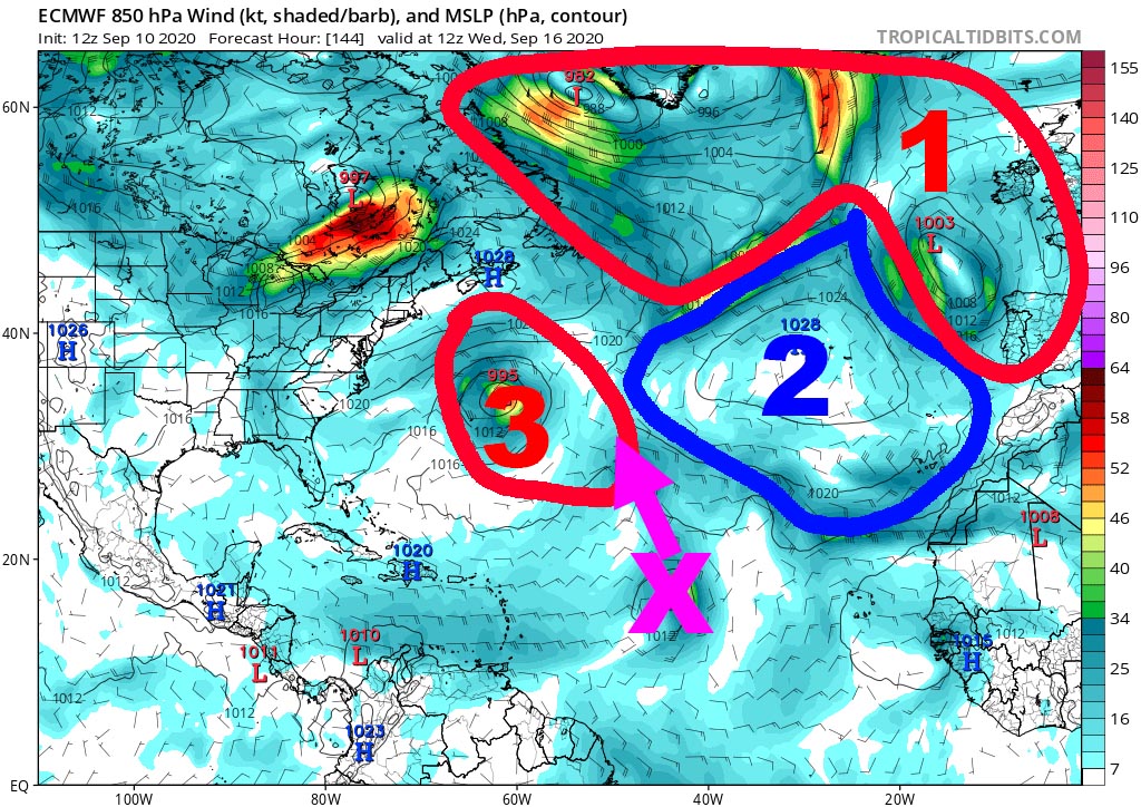
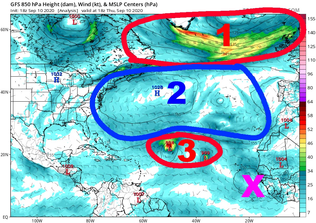
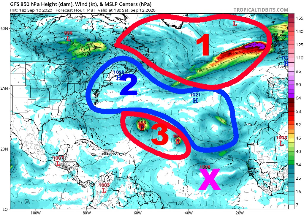
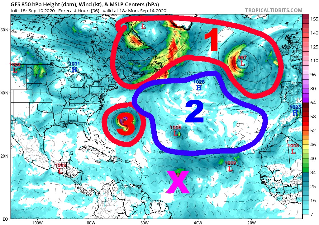
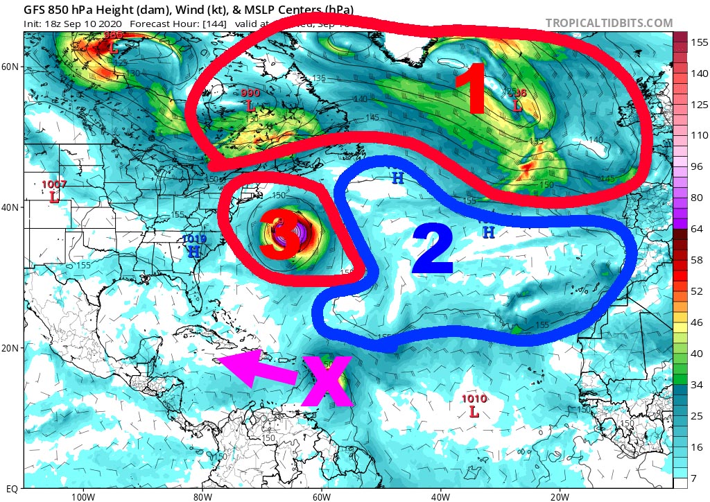
There is still a lot of activity in the Atlantic basin with another 6 disturbed areas followed by the nhc. This morning there were 7 which represented a record. But all eyes have been on one for more than 48 hours. For nearly 5 days the major models (GFS et ECMWF extension) indeed develop a cyclonic system on the Atlantic linked to this disturbance but are still not at all in agreement on its evolution. This fact alone should encourage everyone to be moderated and not to assert loud and clear assumptions that are not based on any reality in terms of forecasting. If the trajectory were to be to the west, it would take another 7 days for this system to arrive on the arc, which is still far too long to hope for a realistic forecast. And above all, the disturbance is still not classified as Invest (this should be done at 20 p.m. given the latest satellite loops which show a marked increase in organization) which greatly limits the tracking tools available.
So, given that we still do not know anything about its future and the risk it could pose on the West Indies or other inhabited areas, we will try to understand why the 2 major models are so opposed in their trajectory forecast, both between them and from one run to another.
Have a global vision of the situation in the Atlantic
To understand what shares the opinions of the models so much, it is necessary to delve a little into the overall situation in the Atlantic Ocean. As we see in the image on the left, we have 3 zones which share the entire ocean:
- Zone 1 in the north in which oceanic depressions circulate fairly quickly.
- Zone 2 over the entire Atlantic center which represents the anticyclone and its extensions, with a small disturbed zone at the level of the Azores.
- Zone 3 which represents the large disturbed zone which includes the 2 storms, Paulette and Rene.
The vision of the ECMWF (Euro) model
The 4 images below show the forecast for theECMWF extension every 48 hours from today at noon and therefore the same overall situation seen above which is the furthest to the left.
The vision of the GFS model
Which one will be right?
It's simple : we don't know! Of course, we all want the European model to be right (except for a few crazy people lacking strong sensations) ... and all the more so since it is often more relevant than the GFS in this type of complex forecast. But the fact that the GFS or on a fairly stable forecast over his last 4 runs is also an indication that should not be overlooked!
This is the whole problem of a hurricane forecast for more than 6 days. The elements which can intervene in the trajectory of a cyclone are numerous in normal times but there with in more 2 systems which move in the vicinity it is simply impossible. Maybe it will be one… maybe the other. Or none of the 2 and it is a third option which may eventually come true. And we must not forget that these versions are those of the run concerned. Tomorrow it will probably be different. This article is intended to aid in understanding air masses / pressure and the complexity of forecasting, not for forecasting as such.
I have said it before and I will say it again: all those who make statements on this subject lie ! Models disagree with each other and sometimes even disagree with themselves 6 hours apart. What we do know, however, is that this disturbance represents a risk for the West Indies and other territories and that at this time of the season we should not joke about it given the temperature of the water. . It will probably not be much and we may spend the next few days asking a lot of questions. So rather than speculating on the unpredictable, let's prepare in case one or the other ends up on the trajectory of this thing without being depressed for something that remains very uncertain.
To follow the evolutions of theInvest 95L is HERE
To be informed live of new articles, you can subscribe to the Facebook group or to the account Twitter.
Image credits; Tropical tidbits, NHC / Noaa, UW-CIMSS