
(Dernière mise à jour Météo Tropicale : Le 25/04 à 17:47 UTC).
Il n’y a pas de cyclone ni de système surveillé par le NHC en Atlantique. Nous ne sommes pas actuellement en période cyclonique
Voir les statistiques de la saison
Cliquez sur l’image pour afficher la carte interactive.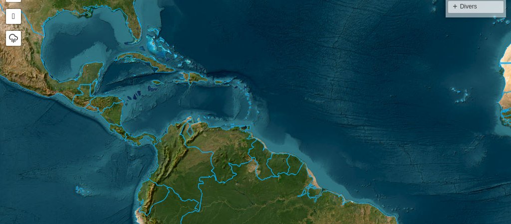
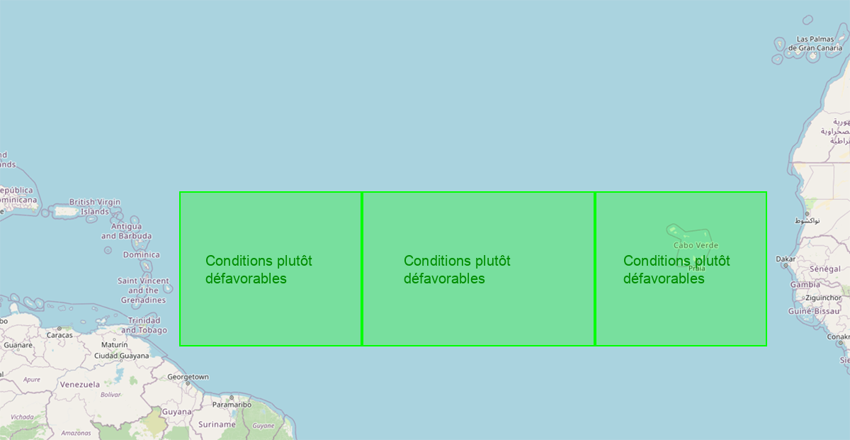 Les conditions de développement cyclonique sont plutôt défavorables sur l’Est de l’Atlantique, sur le centre et sur le large de l’arc antillais.*
Sable et air sec
Le sable et l’air sec sont très présents sur le centre Atlantique et le large de l’arc antillais, et moyennement sur l’Est Atlantique.
Le sud de l’arc antillais est dans une zone de sable plus dense que le nord.
SST (anomalies de températures de l’eau)
La température de l’eau est proche de 28° sur l’est de l’Atlantique, sur le centre et le large de l’arc antillais.
Cisaillement
Le cisaillement est assez fort à fort sur l’ensemble la zone de développement majeure (MDR) en Atlantique.
Attention ! Des conditions défavorables n’indiquent pas forcément qu’il n’y aura pas de cyclone et inversement.
* Cet outil est en version Beta et sa fiabilité n’est pas encore totalement évaluée.
Les conditions de développement cyclonique sont plutôt défavorables sur l’Est de l’Atlantique, sur le centre et sur le large de l’arc antillais.*
Sable et air sec
Le sable et l’air sec sont très présents sur le centre Atlantique et le large de l’arc antillais, et moyennement sur l’Est Atlantique.
Le sud de l’arc antillais est dans une zone de sable plus dense que le nord.
SST (anomalies de températures de l’eau)
La température de l’eau est proche de 28° sur l’est de l’Atlantique, sur le centre et le large de l’arc antillais.
Cisaillement
Le cisaillement est assez fort à fort sur l’ensemble la zone de développement majeure (MDR) en Atlantique.
Attention ! Des conditions défavorables n’indiquent pas forcément qu’il n’y aura pas de cyclone et inversement.
* Cet outil est en version Beta et sa fiabilité n’est pas encore totalement évaluée.

